Rare Books
Official map of the City of Redondo Beach, Los Angeles County, California
You might also be interested in
Image not available
Map of the city of Los Angeles and vicinity
Rare Books
A section of a larger map, probably from city planning department. Numbers top and bottom, letters east side for area designation. Prime meridian: GM. Relief: no. Graphic Scale: Feet. Projection: Plane. Printing Process: Blue line print.
478833

Official map of the city of Beverly Hills Los Angeles County California / Compiled by A. C. Pillsbury, City Engineer
Rare Books
A long map with various tracts delineated. Monuments and recorded maps listed. Numerous MS notes on tracts. Prime meridian: GM. Relief: no. Graphic Scale: Feet. Projection: Plane. Printing Process: Blue line copy. Verso Text: MS notes: 299046 318-A.
299046
Image not available
Map of Santa Fe Springs, Los Angeles Co., California
Rare Books
A map similar to 475753 except concentrating on the holdings of one company. Prime meridian: GM. Relief: no. Graphic Scale: Feet. Projection: Plane. Printing Process: Blue line print.
475754
Image not available
City of Watts : Los Angeles County California ; being a portion of Rancho Tajauta / map compiled from records by L.D. House City Engineer
Rare Books
Blue line tract map before Watts became part of the City of Los Angeles. Relief: no. Graphic Scale: Feet. Projection: Plane. Printing Process: Diazo print.
386276
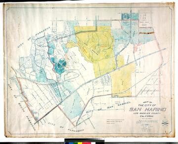
Map of the city of San Marino, Los Angeles County, California
Rare Books
"Scale 1 inch = 300 feet." "The City of San Marino was incorporated as a City of Sixth Class on the 25th day of April 1913 ..." Prime meridian: GM. Relief: no. Graphic Scale: Feet. Projection: Cylindrical. Printing Process: Blue line print. Verso Text: MS notes: City of San Marino Los Robles Ranch colored.
477773
Image not available
Official Map of the City of Azusa Los Angeles Co. California
Rare Books
Lower section badly shredded and poorly repaired. Blueline map on roller. Sierra Madre Ave to the north, Approximately Vernon Avenue to the west, Cerritos Avenue to the east, approx. Paramount St. to the south. "J. H. McClymonds Jr. C.E. 1906." "Corrected to 1909 by A. B. Waddingham City Engineer" Relief: no. Graphic Scale: Feet. Projection: Plane. Printing Process: Blueline print. Verso Text: MS note: 439051.
439051