Visual Materials
Draught of Falklands Islands in the Latitude of 51° 22' South, Longitude 64° 30' West
You might also be interested in
Image not available
South America From the latest Discoveries, Shewing the Spanish & Portuguese Settlements according to Mr. D'Anville, by De Larochette
Visual Materials
Cartouche: ribboned w. coins & arrows.. Prime meridian: Ferro. Relief: pictorial. Graphic Scale: Miles, leagues, paces. Projection: Pseudocylindrical. Watermark: Crowned fleur-di-lis, IHS over Ivilledary. Printing Process: Copper engraving. Other Features: Cartouche. Verso Text: MS notes: 98 105/861.
105:861 M

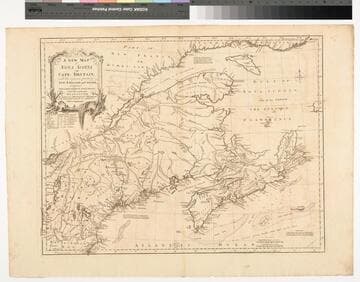
A New Map of Nova Scotia and Cape Britain. with the adjacent parts of New England and Canada, Composed from a great number of actual Surveys ; and other materials Regulated by many new Astronomical Observations of the Longitude as well as Latitude ; with an Explanation
Visual Materials
Kashnor notes, "The first issue of Jefferys' map. It was re-issued twenty years later by Sayer and Bennett." Kershaw states this is the second state of Jefferys map. Prime meridian: London, Ferro. Relief: pictorial. Graphic Scale: Miles, leagues. Projection: Pseudocylindrical. Watermark: I Ville Ary under IHS Crowned fleur-di-lis over LVC. Printing Process: Copper engraving. Other Features: Cartouche. References: Kershaw 739; McCorkle 755.20. Verso Text: MS note: 668.
105:668 M
Image not available
Island and Colony of Cayenne subject to the French, on the Continent of South America. By Thomas Jefferys, Geographer to his Royal Highness the Prince of Wales
Visual Materials
Cartouche: leaved. MS note: 660. Prime meridian: Ferro. Relief: hachures. Graphic Scale: Miles, leagues. Projection: Cylindrical. Watermark: Crowned fleur-di-lis voer LVG IV. Printing Process: Copper engraving. Other Features: Cartouche. Verso Text: MS notes: 660 57.
093:660 S

New Map of the West Indian Islands, as they are Possessed by the European Powers
Visual Materials
Kashnor ontes, "Indicates the English, Dutch, French, and Spanish possessions." Cartouche: branches.. "Drawn from the most Recent Authorities." Prime meridian: London. Relief: pictorial. Graphic Scale: Leagues. Projection: Cylindrical. Watermark: Crowned fleur-di-lis VI. Printing Process: Copper engraving. Other Features: Cartouche. Verso Text: MS note: 966.
105:966 M

St. Christopher's
Visual Materials
Kashnor dates as [1768]. "Surveyed by Anthony Ravell Esqr. Surveyor General of the Islands of St. Christophers, Nevis, & Montserrat. Engraved by Thomas Jefferys Geographer to the King." Relief: hachures. Graphic Scale: Miles. Projection: Plane. Watermark: IHS I. Villadary Crowned fleur-di-lis. Printing Process: Copper engraving. Verso Text: MS note: 781.
105:781 M
Image not available
New Map of Nova Scotia, and Cape Breton Island with the adjacent parts of New England and Canada, Composed from a great number of actual Surveys; and other material Regulated by many new Astronomical Observations of the Longitude as well as Latitude; by Thomas Jefferys, Geographer to the King
Visual Materials
See map 093:269M for earlier edition. Note border change. Prime meridian: Ferro. Relief: pictorial. Projection: Conic. Watermark: Crowned fleur-di-lis VI. Printing Process: Copper engraving. Other Features: Cartouche. Verso Text: MS note: 270 34.
093:270 M