Opening Hours
Daily: 10 A.M.–5 P.M.
Closed on Tuesdays
1151 Oxford Road
San Marino, CA 91108
Daily: 10 A.M.–5 P.M.
Closed on Tuesdays
1151 Oxford Road
San Marino, CA 91108

Image not available
Manuscripts
Possibly Francis Gabriel de Ruvigny?
LO 5511
Image not available
Visual Materials
Kashnor notes, "Includes California, and gives many locations, including those of San Francisco, Monterey, Santa Barbara, San Gabriel and San Diego; also Santa Fe and Taos in New Mexico." Impressed stamp of Carte Encyprotipe.. Prime meridian: Paris. Relief: hachures. Graphic Scale: Miles, leagues. Projection: Conic. Printing Process: Engraving. Verso Text: MS note: 700.
105:223 M
Image not available
Rare Books
Kashnor notes: "Locates Port de Francois Drake and New Albion in California, and Santa Fe and Taos in New Mexico." Framed border surrounds map. Elaborate bordering frame. By either Brion de la Tour, Louis or Brion de la Tour, Louis, d. 1823. Prime meridian: Ferro. Relief: pictorial. Graphic Scale: Leagues. Projection: Azimuthal. Watermark: Device. Printing Process: Copper engraving. Verso Text: MS notes: Cat 93 206 139312.
139312
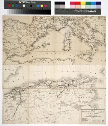
Rare Books
Kirkpatrick Catalogue entry: "2433 l Algeria. Carte des chemins de fer de l'Algérie et de la Tunisie [and of southern Europe, Paris, 1868?]. 1 sheet. [see p.]." Two maps adjoined and backed on one sheet. The title only applies to the bottom half. The top half is unidentified, but is in English, rather than French. Lower left corner of Algerian map contains MS note, "Ain Sefra(?)," in another hand, possibly that of Isabel Burton per Kirkpatrick's speculation. Prime meridian: Paris. Relief: no. Graphic Scale: Kilometers. Projection: Polyconic. Printing Process: Lithography. Verso Text: Stamp: Kensington Public Libraries (5) MS notes: P. Maps Africa Algeria 2433 R.B. 11489,Z Sticker: R.B. 11489.Z.
623607
Image not available
Manuscripts
The collection primarily contains letters and documents relating to Hugh Campbell, 3rd Earl of Loudoun; his son, John Campbell, 4th Earl of Loudoun; other Campbell family members; and various political and military associates. John Campbells military activities during the 1745 to 1746 Jacobite uprising in Scotland and the Seven Years War in North America in 1756 and 1757 are especially documented. Materials in the collection include correspondence, memorials, and petitions; muster rolls, returns, orders, and other military records; appointments; estate records including accounts, bills, receipts, and inventories; and land and government documents.
LO 4171
Image not available
Visual Materials
Kashnor notes, "The Oregon boundary follows the Columbia River, and reaches north to the 53rd parallel. [Kashnor has apparently confused this map with another since this map goes no further north than the 44th parallel.] The map shows Mexico (as) including California, New Mexico and Texas, locating Pt. San Francisco, Hyerba Buena, Monterey, Santa Fé, Taos, &c." "Rédigée par Brué Géographe." "Gravée sous la direction de l'Auteur. Seal of the author. [Map continuation] Gautemala ou Provinces-Unies de l'Amerique Centrale." Continuation map at different scale. Submap: Iles Revillagigedo.. Prime meridian: Paris. Relief: hachures. Projection: Pseudocylindrical. Printing Process: Engraving. Other Features: Sub-maps. Verso Text: MS note: 223.
105:700 M