Maps and Atlases
The Huntington has a rich and varied selection of European and American cartographic material that supports historical and geographical research and includes numerous rarities.
The Library’s pre-1800 print holdings are outstanding. Continental works include 36 editions of Ptolemy’s Cosmographia as well as numerous editions of the works of Sebastian Münster and Abraham Ortelius. The great Dutch mapmakers—the Mercator, Hondius, Blaeu, Visscher, and Goos families—are all well represented. English material is the strongest, with such highlights as Christopher Saxton’s Atlas of the Counties of England & Wales (ca. 1590), and Joseph Des Barres’ volume of coastal charts, The Atlantic Neptune (1784). Notable post-1800 holdings include the Sir Richard Francis Burton Map Collection.
American cartographic materials reflect the Library’s interest in Colonial and Revolutionary War America, the Trans-Mississippi West, and California. Mapmakers represented include Mathew Carey, Lewis Evans, William Faden, John Melish, and John Mitchell. For the 19th century, there are abundant state and road, Civil War, geological, and topographical survey maps. For Los Angeles, the Solano-Reeve collection and the Los Angeles County Assessor’s Road Maps are invaluable resources.
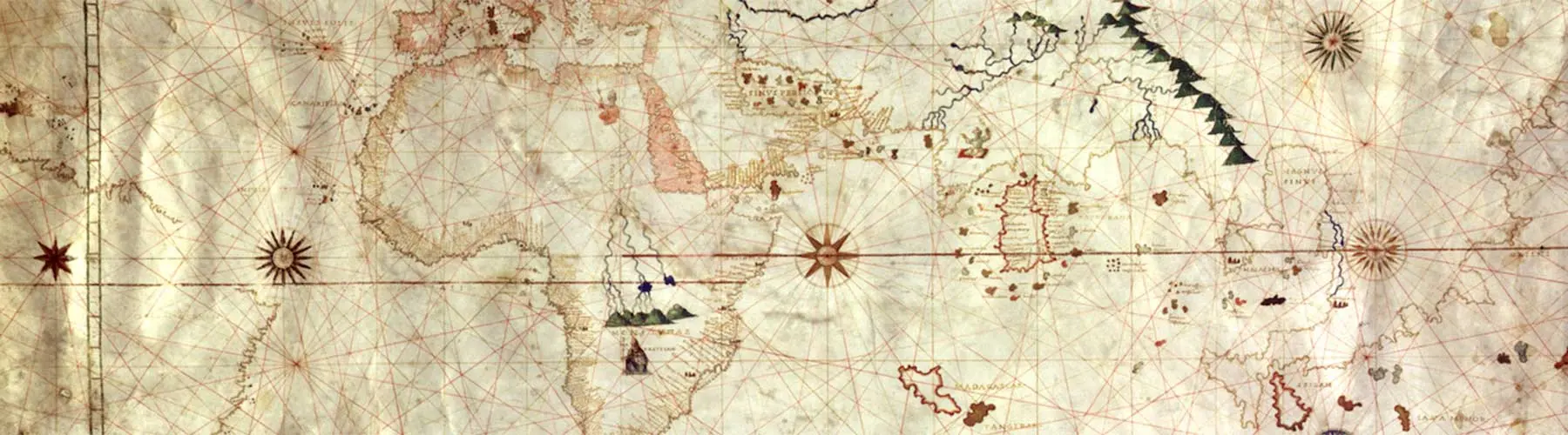
The Huntington holds a truly distinguished collection of early manuscript maps, including a world map in Ranulf Higden’s “Polychronicon” of the 1340s and a choice selection of portolan maps and atlases. Among the most important of the latter are the King/Hamy world chart, with its outline of South America, reflecting voyages on which Amerigo Vespucci sailed. The splendid Vallard Atlas, created no later than 1547, is one of the most visually impressive examples of the Norman or Dieppe school of cartography.
Digital Resources:
Sir Richard Francis Burton Maps
Kashnor Collection of Early American Maps, 1670–1856
Los Angeles County Assessor’s Road Maps
Los Angeles County Regional Planning Commission
Museum Bookstore Maps of the Americas and the West Indies from the 16th to the 19th centuries, purchased from the Museum Book Store, London
Portolans
Solano-Reeve collection of Los Angeles survey maps
Tract Maps from Southern California
Banner image credit: Portolan Chart, (“King-Hamy Portolan Chart”), 16th century. HM 45. Purchased from A. S. W. Rosenbach, 1923.