Opening Hours
Daily: 10 A.M.–5 P.M.
Closed on Tuesdays
1151 Oxford Road
San Marino, CA 91108
Visual Materials
Daily: 10 A.M.–5 P.M.
Closed on Tuesdays
1151 Oxford Road
San Marino, CA 91108

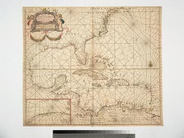
Visual Materials
Kashnor dates as [1696]. Cartouche: Putti with navigational instruments. Submap: Channel between Cuba and Florida.. Prime meridian: Ferro. Relief: no. Graphic Scale: miles. Projection: Cylindrical. Watermark: CS. Printing Process: Copper engraving. Other Features: CartoucheSubmaps.
093:731 M
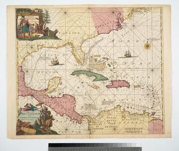
Visual Materials
Kashnor notes, "Shows part of North America, including Carolina, Florida, Virginia, and New England, locating Charleston, Port Royal, Nieu Amsterdam, and Manhathans Eyl." Kashnor dates as ca. 1690. Appears in Renard's Atlas de la navigation et du commerce (1715), RB 238460 - date and author's full name taken from that. State 3 of de Wit's map of the same name from 1675 (Burden No. 469). Cartouche: two elaborate scenes with Natives. MS note: 1690. Relief: no. Projection: Cylindrical. Printing Process: Copper engraving. Verso Text: MS note: 105-346.
105:346 M
Image not available
Visual Materials
Kashnor notes, "Shows a good outline of Yucatan, Honduras and the Isthmus of Panama." Cartouche: Natice children.. Relief: no. Graphic Scale: Leagues. Projection: Cylindrical. Printing Process: Copper engraving. Other Features: Cartouche. Verso Text: MS note: 695.
093:695 M
Image not available
Visual Materials
Kashnor notes, "Shows the coast from Boston Harbor to the Chesapeake. The inset map locates New York, Bergen, West Chester and Flushing, Brookland, Newtown, Flatbush, Bedford, Utrecht and Gravesend on Long Island; in New Jersey it locates Newark, Woodbridge and Elizabeth Towne. Perth Citty, Dockura and Middletown." Kashnor dates ca. 1680. McCorkle confirms this is first edition, 1680. Submap: New York Harbor Cartouche with putti.. Relief: pictorial. Graphic Scale: Miles. Projection: Cylindrical. Printing Process: Copper engraving. Other Features: Sub-mapsCartouche. References: McCorkle 680.4. Verso Text: MS note: 93 489.
093:489 M
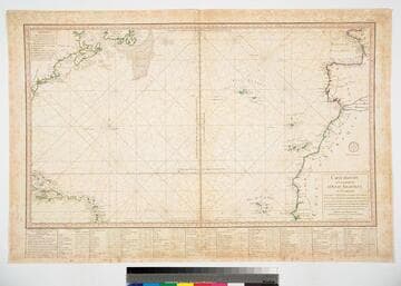
Visual Materials
Kashnor notes, "Shows part of Newfoundland, Canada and New England, Haiti, Porto Rico and Leeward Isles." Table with latitude and longitude readings for coastal places.. Prime meridian: Paris. Relief: no. Graphic Scale: Leagues. Projection: Cylindrical. Printing Process: Copper engraving. Verso Text: Ms note: 712.
093:712 M
Image not available
Visual Materials
Kashnor notes, "Showing Patagonia and Tierra del Fuego, and the entrance to La Plata, locating Buenos Ayres and Monte Video." Kashnor dates as ca. 1670. Cartouche: cherubs.. Relief: no. Graphic Scale: Leagues. Projection: Cylindrical. Printing Process: Copper engraving. Other Features: Cartouche. Verso Text: MS note: 700.
093:700 M