Opening Hours
Daily: 10 A.M.–5 P.M.
Closed on Tuesdays
1151 Oxford Road
San Marino, CA 91108
Rare Books
Daily: 10 A.M.–5 P.M.
Closed on Tuesdays
1151 Oxford Road
San Marino, CA 91108

Rare Books
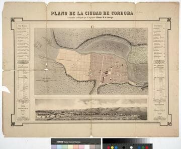
Kirkpatrick Catalogue entry: "2467 d Laberge, A. M. Plano de la ciudad de Cordoba. Paris, Imp. Destouches, 1860. 1 sheet. [see p.]."Numerous indecipherable notes in Burton's hand. Probably obtained while Burton was in South America between 1865 and 1868. Vignette: Vista Tomada desde el alto del Pucara Novembre 1860. MS note: El Lueco, many more in Burton's hand.. Prime meridian: Paris. Relief: hachures. Graphic Scale: Varas (1000 varas shown as 3.25"). Projection: Plane. Printing Process: Lithography. Other Features: Vignettes. Verso Text: MS notes: Cordona R.B. 11491. r. p maps Americas Lebarge 2467. Stamp: Kensington Public Libraries..
623642
Image not available
Visual Materials
Kashnor notes, "An exceedingly rare map of this colony, established about 10 leagues from Buenos Ayres." Submap: Parte de la Costa Septentrional del Rio de la Plata.. "Situada sobre la Costa Septentrional del Rio de la Plata. Demuestrase las Baterias, y ataques, que la pusieron los Espanoles el dia 1st Octobre del Ano de 1762, mandados por el Exmc. S. D. Pedro Cevallos, a quines se rindio a fines de dtho. mes y Ano. Por D. Tomas Lopez, Madrid, Ano de 1777." "Se hallara este con todes las Obras del Autor, en Madrid, en la Cale de las Carretas." Relief: hachures. Graphic Scale: varas, toesas. Projection: Plane. Watermark: BRVMEV. Printing Process: Copper engraving. Other Features: Sub-maps. Verso Text: MS note: 867.
105:867 M
Image not available
Visual Materials
This is Sanson's version of famous de l'Isle map with South America curving west. See 093:610 or RB 295821. Kashnor dates as ca. 1680, but de l'Isle's map preceded this one. Kashnor notes, "Shows the Argentine provinces as "Provinces de Rio de la Plata." Cartouche: Figures & scrolling. MS note: No. 1 (upper left). Prime meridian: Ferro. Relief: pictorial. Graphic Scale: Leagues. Projection: Pseudocylindrical. Printing Process: Copper engraving. Verso Text: MS notes: 631.
093:631 M
Image not available
Rare Books
In upper right corner: 22. This map is another copy of map 93:537 and 105:646 from the Museum Bookstore Collection. Cartouche: floral Submap: Supplement pour la Caroline. Prime meridian: Paris. Relief: pictorial. Projection: Cylindrical. Watermark: Circular device- lettering. Printing Process: Copper engraving. Verso Text: Cours de l'Ohio MS notes: Maps - U.S. Robert de Vaugondy, Gilles Paris 1755 44193 835 30 319. Reference: McCorkle, map 755.37; McCorkle, map 295.
44193
Image not available
Visual Materials
Kashnor notes, "Shows the Argentine provinces as 'Provinces de Rio de la Plata'." [Shows l'Isle's 1700 version of this map with westward tilting South America.] See also 093:610M. Alt. title from upper margin. Cartouche: Natives. Prime meridian: Ferro. Relief: pictorial. Graphic Scale: Leagues. Projection: Pseudocylindrical. Printing Process: Copper engraving. Verso Text: MS note: 836.
105:836 M
Rare Books
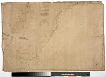
Kirkpatrick Catalogue entry: "2471 d Mouchez, E. Carte routière de la côte du Brésil de Rio Janerio au Rio de la Plata et au Paraquay. [Rio de Janerio], Dépôt des Cartes et Plans de la Marine, 1864. 1 sheet. [see cabinet]."Printers information incomplete because of damage to lower left corner. MS notes off the coast which seem to mark the progress of a voyage. Probably obtained while Burton was in South America between 1865 and 1868. MS notes: Burton (map cabinet) Mouchez. Prime meridian: Paris. Relief: no. Projection: Cylindrical. Printing Process: Lithography.
623645