Rare Books
Map of the City of San Marino Los Angeles County California / compiled from County Records by William Chalmers - City Engineer
You might also be interested in
Image not available
Map of the City of San Marino Los Angeles County California compiled from County Records / by William Chalmers - City Engineer
Rare Books
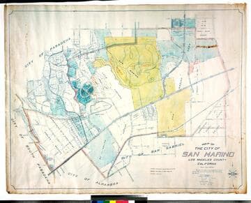
Covers the area from Milan Street on the west, Rose Avenue (San Gabriel Blvd.) on the east, San Pasqual St. on the north, Alhambra Road to the south. See map 251107 for a smaller, earlier version of this map. Relief: no. Graphic Scale: Feet. Projection: Plane. Printing Process: Blueline print.
234876
Image not available
Map of the city of San Marino, Los Angeles County, California / compiled from county records by William Chalmers - City Engineer
Rare Books
Library has been built, so about 1920. See 251107 for another edition, reduced in size. "The City of San Marino was incorporated as a City of the Sixth Class on the 25th day of April 1913 with the following City Officials: George S. Patton, President, Trustees: William L. Valentine, R. H. Lacy, E. G. Hart, E. H. Groendyke, H. F. Stewart, City Treasurer, W. B. Rees, City Clerk." Relief: no. Graphic Scale: Feet. Projection: Plane. Printing Process: Blue line print. Verso Text: MS notes: City of San Marino.
477778
Map of the city of San Marino, Los Angeles County, California
Rare Books
"Scale 1 inch = 300 feet." "The City of San Marino was incorporated as a City of Sixth Class on the 25th day of April 1913 ..." Prime meridian: GM. Relief: no. Graphic Scale: Feet. Projection: Cylindrical. Printing Process: Blue line print. Verso Text: MS notes: City of San Marino Los Robles Ranch colored.
477773
Image not available
Map of Los Angeles County California : Completely indexed compiled from Official County and City Records and other sources / by American Surveys Incorporated
Rare Books
Wall map of county. Submaps: Central Business District; Marginal Map showing Santa Catalina Island and San Clemente Island Los Angeles County with reference to the mainland. Prime meridian: GM. Relief: hachures. Graphic Scale: Miles. Projection: Cylindrical. Printing Process: Blueline print.
268913
Image not available
Map of the City of Whittier Los Angeles Co. California
Visual Materials
Old shelf number: eph J5-12(1). Whittier got its charter and was incorporated in 1898, so map postdates that. For a pre-charter map of Whittier, see RB ephMPCALIF0034. County Road is now Whittier Blvd. Based on the Baldwin, Jessup & Co. map, the city has expanded. Prime meridian: GM. Relief: no. Graphic Scale: Feet. Projection: Cylindrical. Printing Process: Blueprint. Verso Text: MS notes: Eph J5-12(1). Map of the City of Whittier.
ephMPCALIF0035
Image not available
Aerial survey city of San Marino in the County of Los Angeles California
Rare Books
Aerial survey map of San Marino. Photograph pasted on paper with linen backing. Projection: Plane. Printing Process: Photograph. Verso Text: MS notes: San Marino City Aerial View.
371749