Rare Books
This Map of the Province of Nova-Scotia and parts adjacent
You might also be interested in
Image not available
Map of New England and Nova Scotia; with part of New York, Canada, and New Britain & the adjacent Islands of New Found Land Cape Breton &c. by Tho. Kitchin Geogr
Visual Materials
Kashnor notes, "A scarce map issued at the time of the Old French War." RLIN record gives date and published in information. Cartouche: harbor/forest scene. MS note: 280 (on backing). Prime meridian: London. Relief: pictorial. Graphic Scale: Miles. Projection: Cylindrical. Watermark: Seal circular device. Printing Process: Copper engraving. Other Features: Cartouche. References: Kershaw 708; McCorkle 758.7. Verso Text: MS note: 280 (on backing).
093:280 S
Image not available
Map of the most Inhabited part of New England containing the Provinces of Massachusets Bay and New Hampshire, with the Colonies of Conecticut and Rhode Island, Divided into Counties and Townships: The whole composed from Actual Surveys and its situation adjusted by Astronomical Observations
Visual Materials
Kashnor notes, "This is the old Colonial Map, originally engraved and issued by Thomas Jefferys, the plate having passed into the possession of the firm when the Jefferys and Sayer, and Sayer and Bennett firms became Laurie and Whittle." Two submaps. Patterned after Jeffreys' 1755 map, see McCorkle 755.19. Cartouche: Landing of the Mayflower at Plymouth. Submaps: Plan of the Town of Boston; Plan of Boston Harbor from an Accurate Survey.. Prime meridian: London. Relief: pictorial. Graphic Scale: Miles, leagues. Projection: Cylindrical. Printing Process: Copper engraving. Other Features: Sub-mapsCartouche. References: McCorkle 755.19.. Verso Text: MS notes: 457 England 4 Sheets (one sheet)..
093:457 M
Image not available
New Map of Canada, Also the North Parts of New England and New York; with Nova Scotia and Newfound Land. From the Sr. Robert with Improvements
Visual Materials
Kashnor dates as ca. 1760. Submap of the Great Lakes. [Shows south limits of Canada including everything north of the 41st parallel west of Michigan.] See 105:671 for an earlier version of this map. McCorkle gives appeared in information. Submap: Supplement for the Lakes of Canada. MS note: 303 (on backing). Prime meridian: London. Relief: pictorial. Graphic Scale: Miles, leagues. Projection: Pseudocylindrical. Printing Process: Copper engraving. Other Features: Sub-maps. References: Kershaw 370; McCorkle 759.3. Verso Text: MS note: 303 (on backing).
093:303 S

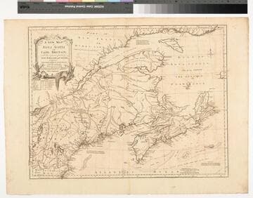
A New Map of Nova Scotia and Cape Britain. with the adjacent parts of New England and Canada, Composed from a great number of actual Surveys ; and other materials Regulated by many new Astronomical Observations of the Longitude as well as Latitude ; with an Explanation
Visual Materials
Kashnor notes, "The first issue of Jefferys' map. It was re-issued twenty years later by Sayer and Bennett." Kershaw states this is the second state of Jefferys map. Prime meridian: London, Ferro. Relief: pictorial. Graphic Scale: Miles, leagues. Projection: Pseudocylindrical. Watermark: I Ville Ary under IHS Crowned fleur-di-lis over LVC. Printing Process: Copper engraving. Other Features: Cartouche. References: Kershaw 739; McCorkle 755.20. Verso Text: MS note: 668.
105:668 M

New and Correct Map of the British Colonies in North America Comprehending Eastern Canada with the Province of Quebec, New Brunswick, Nova Scotia, and The Government of Newfoundland: with the Adjacent States of New England, Vermont, New York, Pennsylvania and New Jersey
Visual Materials
Lays out boundaries of French fishing rights and shows old boundary of French territory of Quebec. See 105:308M for another copy. Kershaw lists a third state of this map with Laurie & Whittle as publishers, but dated 1st Jany. 1794, also gives appeared in information. Beaver surmounts cartouche.. Prime meridian: London. Relief: pictorial. Graphic Scale: Miles. Projection: Conic. Printing Process: Copper engraving. Other Features: Cartouche. References: Kershaw 717; LC Phillips 6009; McCorkle 794.12. Verso Text: MS note: 247.
093:247 M
Image not available
Part of North America; containing Canada, the north parts of New England and New York; with Nova Scotia and Newfound Land. From the Sr. Robert with Improvements
Visual Materials
Kashnor dates as ca. 1760. Submap of Great Lakes. See 093:303 for a later version of this map. McCorkle identifies as a smaller version of Robert de Vaugondy's map originally printed in 1775. Submap: Supplement for the Lakes of Canada. MS note: 671 (on backing).. Prime meridian: London. Relief: pictorial. Graphic Scale: Miles, Leagues. Projection: Pseudocylindrical. Printing Process: Copper engraving. Other Features: Sub-maps. References: Kershaw 369; McCorkle 759.3.
105:671 S