Opening Hours
Daily: 10 A.M.–5 P.M.
Closed on Tuesdays
1151 Oxford Road
San Marino, CA 91108
Visual Materials
Daily: 10 A.M.–5 P.M.
Closed on Tuesdays
1151 Oxford Road
San Marino, CA 91108

Image not available
Visual Materials
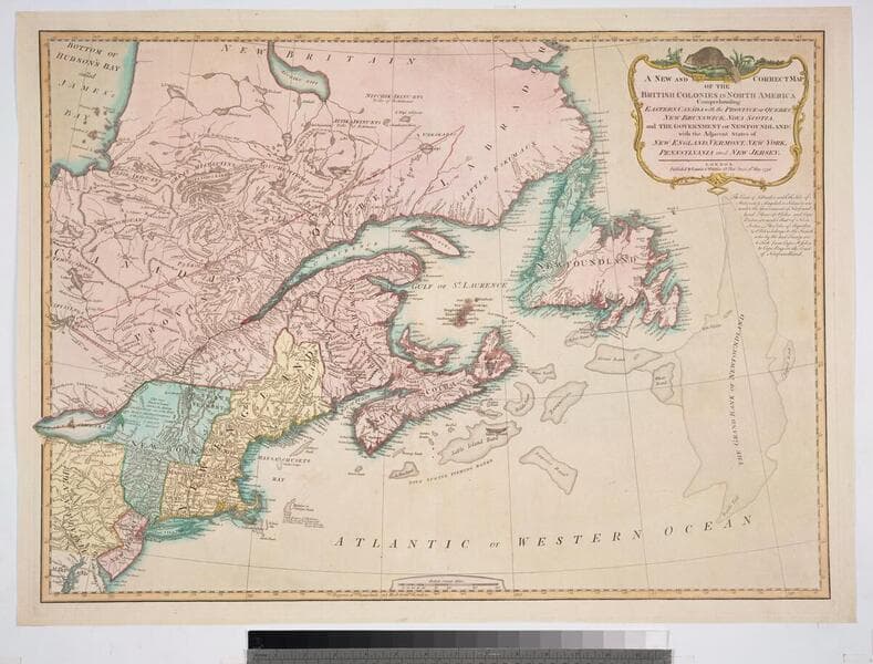
Lays out boundaries of French fishing rights and shows old boundary of French territory of Quebec. See 093:247M for another copy. Beaver surmounts cartouche.. Prime meridian: London. Relief: pictorial. Graphic Scale: Miles. Projection: Conic. Printing Process: Copper engraving. Other Features: Cartouche. References: Phillips 6016; McCorkle 790.12. Verso Text: MS note: 308.
105:308 M
Visual Materials
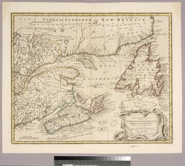
Variant of 105:561. Kashnor dates as ca. 1752. Kershaw identifies as Second State of Bowen's map and supplies appeared in information. Prime meridian: London. Relief: pictorial. Graphic Scale: Miles. Projection: Pseudocylindrical. Printing Process: Copper engraving. Other Features: Cartouche. References: Kershaw 694; LC Phillips 614. Verso Text: MS note: 262.
093:262 M
Image not available
Visual Materials
"Drawn from the most approved Modern Maps and Charts, and Regulated by Astront. Observatns. by Eman Bowen." Variant of 093:262. Kashnor dates as ca. 1752. Kershaw identifies this as the first state of Bowen's map, published in 1747. Prime meridian: London. Relief: pictorial. Graphic Scale: Miles. Projection: Pseudocylindrical. Printing Process: Copper engraving. Other Features: Cartouche. References: Kershaw 693; LC Phillips 603. Verso Text: MS note: 561.
105:561 M
Image not available
Visual Materials
See map 093:270M for later edition. RLIN record provides appeared in information. Kershaw identifies this as the fourth state of Jefferys' map. Prime meridian: Ferro. Relief: pictorial. Projection: Conic. Watermark: Crowned fleur-di-lis VI. Printing Process: Copper engraving. Other Features: Cartouche. References: Kershaw 745; LC Phillips 1166,1208. Verso Text: MS note: 269.
093:269 M
Image not available
Visual Materials
Kashnor notes, "A scarce map issued at the time of the Old French War." RLIN record gives date and published in information. Cartouche: harbor/forest scene. MS note: 280 (on backing). Prime meridian: London. Relief: pictorial. Graphic Scale: Miles. Projection: Cylindrical. Watermark: Seal circular device. Printing Process: Copper engraving. Other Features: Cartouche. References: Kershaw 708; McCorkle 758.7. Verso Text: MS note: 280 (on backing).
093:280 S
Image not available
Visual Materials
Kashnor notes the cartouche contains a view of Louisburg on Cape Breton Island under attack. Several submaps. Later English copy of Bellin's map. Kashnor dates as ca. 1758. Kershaw suggests 1746 as publication date. McCorkle agrees. Submaps: Atlantic Ocean; Plan of the City and Port of Louisbourg [Cape Breton Island];Fort Dauphin; Quebec City. Cartouche with battle scene. MS note: 290 (on backing).. Prime meridian: London. Projection: Mercator. Printing Process: Copper engraving. Other Features: Sub-maps. References: Kershaw 692; McCorkle 746.1. Verso Text: MS note: 290 (on backing)..
093:290 M