Opening Hours
Daily: 10 A.M.–5 P.M.
Closed on Tuesdays
1151 Oxford Road
San Marino, CA 91108
Visual Materials
Daily: 10 A.M.–5 P.M.
Closed on Tuesdays
1151 Oxford Road
San Marino, CA 91108

Image not available
Visual Materials
Kashnor notes, "A scarce map issued at the time of the Old French War." RLIN record gives date and published in information. Cartouche: harbor/forest scene. MS note: 280 (on backing). Prime meridian: London. Relief: pictorial. Graphic Scale: Miles. Projection: Cylindrical. Watermark: Seal circular device. Printing Process: Copper engraving. Other Features: Cartouche. References: Kershaw 708; McCorkle 758.7. Verso Text: MS note: 280 (on backing).
093:280 S
Image not available
Visual Materials
Kashnor dates as ca. 1760. Submap of the Great Lakes. [Shows south limits of Canada including everything north of the 41st parallel west of Michigan.] See 105:671 for an earlier version of this map. McCorkle gives appeared in information. Submap: Supplement for the Lakes of Canada. MS note: 303 (on backing). Prime meridian: London. Relief: pictorial. Graphic Scale: Miles, leagues. Projection: Pseudocylindrical. Printing Process: Copper engraving. Other Features: Sub-maps. References: Kershaw 370; McCorkle 759.3. Verso Text: MS note: 303 (on backing).
093:303 S
Image not available
Visual Materials
Kashnor notes, "a scarce little map with inset map of the Island of Cape Breton." Kershaw identifies appeared in information. Submap; Map of the Island of Cape Breton. MS note: 319 (on backing).. Prime meridian: London. Relief: pictorial. Graphic Scale: Miles. Projection: Plane. Printing Process: Copper engraving. Other Features: Sub-maps. References: Kershaw 910. Verso Text: MS note: 319 (on backing)..
093:319 S
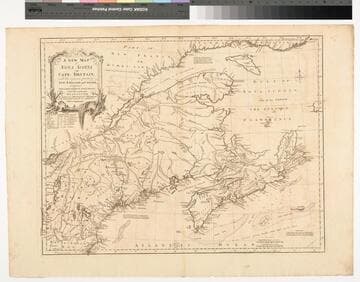
Visual Materials
Kashnor notes, "The first issue of Jefferys' map. It was re-issued twenty years later by Sayer and Bennett." Kershaw states this is the second state of Jefferys map. Prime meridian: London, Ferro. Relief: pictorial. Graphic Scale: Miles, leagues. Projection: Pseudocylindrical. Watermark: I Ville Ary under IHS Crowned fleur-di-lis over LVC. Printing Process: Copper engraving. Other Features: Cartouche. References: Kershaw 739; McCorkle 755.20. Verso Text: MS note: 668.
105:668 M
Image not available
Visual Materials
Kashnor notes, "a fine chart, one of the earliest published charts of Newfoundland." Lightly printed. Kashnor dates as ca. 1752. Kershaw notes this plate was used till 1775 when "it was extremely worn and the impressions for several of the last editions are poor." Kershaw gives appeared in information. Submaps: Trinity Harbour; St. Johns Harbour; Chedabucto Harbour in Nova Scotia. Relief: no. Graphic Scale: Leagues, Miles. Projection: Plane. Printing Process: Copper engraving. Other Features: Sub-maps. References: Kershaw 523. Verso Text: MS note: 562.
105:562 M
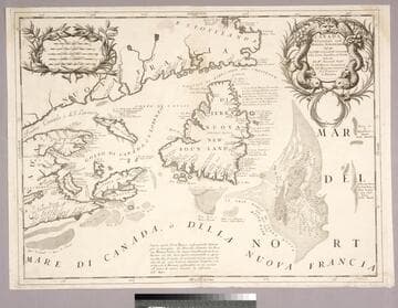
Visual Materials
Kashnor notes, "Showing the mouth of the St. Laurence, with Newfoundland, Cape Breton Island, and parts of Nova Scotia and the Coast of Canada." Kashnor dates ca. 1690. Coronelli was active in Venice. Fish entwined cartouche.. Relief: no. Graphic Scale: Miles, leagues. Projection: Cylindrical. Watermark: Small circled fleur-di-lis.. Printing Process: Copper engraving. Other Features: Cartouche. References: Kershaw (Canada) 162. Verso Text: MS note: 251.
093:251 M