Opening Hours
Daily: 10 A.M.–5 P.M.
Closed on Tuesdays
1151 Oxford Road
San Marino, CA 91108
Manuscripts
Daily: 10 A.M.–5 P.M.
Closed on Tuesdays
1151 Oxford Road
San Marino, CA 91108

![Elevation of the store-house built at Fort-George: [cartographic material] which contains 2500 barrels of flower](/_next/image?url=https%3A%2F%2Frail.huntington.org%2FIIIF3%2FImage%2F22APN4MONA5I%2Ffull%2F%5E360%2C%2F0%2Fdefault.jpg&w=750&q=75)
Manuscripts
Manuscript plan showing outside, cross-section and top-view layout of the flour store house at Fort George. Located along the Hudson River at the junction with the Fish Creek River, the fort was later renamed Fort Hardy, which is located in modern day Schuylerville, Saratoga County, New York. Kashnor attributes the map to James Gabriel Montresor, the British engineer, who drew several maps of Fort George in late June 1759.
mssHM 15456
![Plan and sections of Fort-George. [cartographic material] : Built upon Hudson's River: A.D. 1757](/_next/image?url=https%3A%2F%2Frail.huntington.org%2FIIIF3%2FImage%2F22APN4MO7KI8%2Ffull%2F%5E360%2C%2F0%2Fdefault.jpg&w=750&q=75)
Manuscripts
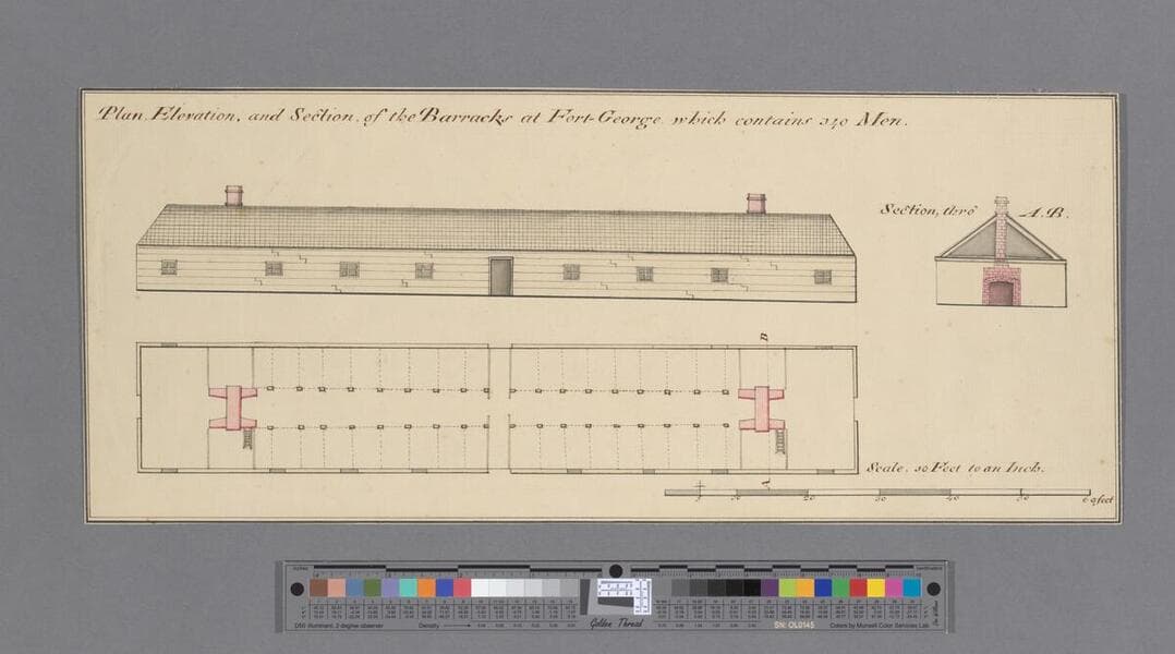
Manuscript plan showing Fort George, with barracks, storehouse, gate and gun platform depicted. Located along the Hudson River at the junction with the Fish Creek River. Later renamed Fort Hardy, which is located in modern day Schuylerville, Saratoga County, New York. Kashnor attributes the map to James Gabriel Montresor, the British engineer, who drew several maps of Fort George in late June 1759.
mssHM 15454
![Plan of Fort Cumberland [cartographic material]](/_next/image?url=https%3A%2F%2Frail.huntington.org%2FIIIF3%2FImage%2F22APN4MOI985%2Ffull%2F%5E360%2C%2F0%2Fdefault.jpg&w=750&q=75)
Manuscripts
A manuscript map showing Fort Cumberland, New Brunswick (formerly Fort Beauséjour). Copy by Charles Rivez; the "Explanation" is in another hand. The map shows the profile of the fortifications for several sections. Kashnor attributes the original to Richard Gridley.
mssHM 15414
![Plan of the fort on Georges Island. [cartographic material]](/_next/image?url=https%3A%2F%2Frail.huntington.org%2FIIIF3%2FImage%2F22APN4MOZJ27%2Ffull%2F%5E360%2C%2F0%2Fdefault.jpg&w=750&q=75)
Manuscripts
Manuscript plan, a copy by Samuel Holland, showing a fort on Georges Island. Kashnor, in the Museum Book Store catalog, locates Georges Island on the Hudson River, just above the junction with Fish Creek River in Saratoga County. The location of Georges Island, or its modern-day name has not been verified.
mssHM 15455
![Plan of the South Fort at Halifax and the Fort of St. George's Island with three elevations. [cartographic material]](/_next/image?url=https%3A%2F%2Frail.huntington.org%2FIIIF3%2FImage%2F22APN4MOI7DQ%2Ffull%2F%5E360%2C%2F0%2Fdefault.jpg&w=750&q=75)
Manuscripts
Manuscript map showing southern limits of Halifax, with the South Battery, the fort and number of mounted guns. Georges Island is depicted in detail with a proposed plan of fortifications. The island was named after King George II shortly after Halifax was settled by the British in 1749 and has been known as "George's Island" and more currently "Georges Island".
mssHM 15426
![Fort Herkimer and environs [cartographic material]](/_next/image?url=https%3A%2F%2Frail.huntington.org%2FIIIF3%2FImage%2F22APN4MOZHBU%2Ffull%2F%5E360%2C%2F0%2Fdefault.jpg&w=750&q=75)
Manuscripts
Manuscript map done by Emmanuel Hess depicting a portion of the Mohawk River with Canada Creek and showing Fort Herkimer (sometimes spelled "Herkemans") on the north bank, along with several outbuildings: barn, houses, church, etc. The map shows the outline of the old fort destroyed by Webb in his retreat from defeat at Oswego. Also shows the road to Albany.
mssHM 15448