Opening Hours
Daily: 10 A.M.–5 P.M.
Closed on Tuesdays
1151 Oxford Road
San Marino, CA 91108
Visual Materials
Daily: 10 A.M.–5 P.M.
Closed on Tuesdays
1151 Oxford Road
San Marino, CA 91108

Image not available
Rare Books
Alt. title from merchant label on verso. "Ch. Picquet, Géographe ordinaire Du Roi et de S.A.S. Monseigr. le Duc d'Orléans. Amérique Septentrionale 1816. A Paris, Quai de Conti No. 17, entre l'Hotel des Monnaies et le Pout de Arts." Shows Southwestern United States as provinces of Mexico. Submaps: Saint Dominique; La Martinique; Le Guadeloupe; La Aleutiennes. Prime meridian: Paris. Relief: hachures. Graphic Scale: Miles, leagues. Projection: Polyconic. Printing Process: Copper engraving.
284681
Image not available
Visual Materials
Kashnor notes, "Shows the course of the Missouri extending north of the Rockies, where the Spaniards forded the river to trade with the people for yellow iron, "du fer jaune." Also shows Carolina, Virginia, Maryland, and New Mexico." Kashnor dates as ca. 1720. This edition shows New Orleans. Submap of the Mississippi delta. MS note: 41 (upper right). Appeared in information from RLIN record. See 093:550M for an earlier version, 150047 for the same version, and 52352 for a reproduction. Submap: Carte Particuliere des Embouchures de la Riviere S. Louis et de la Mobile. Prime meridian: Ferro. Relief: pictorial. Graphic Scale: Leagues. Projection: Cylindrical. Printing Process: Copper engraving. Verso Text: MS note: 478.
105:478 M
![Tabula novissima atque accuratissima Caraibicarum insularum sive Cannibalum : quae etiam Antillae Gallicae dicuntur, item insulae Supraventum, et in Archipelago Mexicano sitae sunt, ac detectae a Christ. Columbo Ao. [1493] nunc demum post varios aliorum conatus ex peritissimorum nautarum tabulis ac diariis, aliisque virorum solertium observationibus de natura ac fertilitate harum insularum, diligenter confecta, et in lucem edita / a Reinero Ottens Amstelaedamensi Geographo](/_next/image?url=https%3A%2F%2Frail.huntington.org%2FIIIF3%2FImage%2F22APN4KVGZCH%2Ffull%2F%5E360%2C%2F0%2Fdefault.jpg&w=750&q=75)
Visual Materials
Kashnor notes, "A fine map with historical notes on the discovery and occupation of the various islands." Kashnor dates ca. 1750. Submap: Peculiaruis tabula insulae Martinico... (map of Martinique). Prime meridian: Ferro. Relief: pictorial. Graphic Scale: Leagues. Projection: Cylindrical. Printing Process: Copper engraving. Verso Text: MS notes: 511 VL. 50.
105:511 M
Image not available
Visual Materials
Kashnor notes, "Includes the Bahamas and a portion of Cuba." MS note in French, lower right. Submap of Mississippi delta. Cartouche: draped. Submap: Carte des Embouchures du Fleuve St. Louis. Seal of Depot de la Marine. MS notes: lower right (in French). Prime meridian: Paris. Relief: no. Graphic Scale: Leagues. Projection: Cylindrical. Watermark: Shield lettering. Printing Process: Copper engraving. Other Features: CartoucheSub-maps. Verso Text: MS note: 480 M2.
105:480 M
Visual Materials
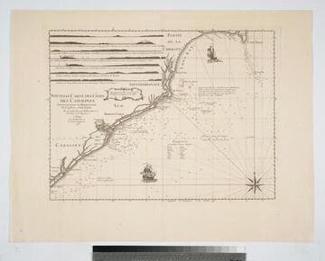
Kashnor notes, "A scarce chart. It was issued for the use of the officers of French ships-of-war and transports during the American Revolution." Six coastal sectional views. Two ships, Compass rose.. Prime meridian: London. Relief: no. Graphic Scale: Leagues. Projection: Cylindrical. Watermark: Chained Maltese cross lettering. Printing Process: Copper engraving. Other Features: Art Work. Verso Text: MS note: 78.
105:078 M
Visual Materials
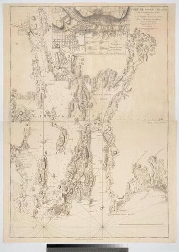
Kashnor notes, "A very rare map, issued for use of the commanders of the French warships during the Revolution." One map in two sheets, with insert map of Newport. Submap of Newport, RI. Prime meridian: GM. Relief: hachures. Graphic Scale: Miles. Projection: Mercator. Watermark: Chained Maltese cross lettering. Printing Process: Copper engraving. Other Features: Sub-maps. Verso Text: Upper MS note:11. Lower sheet MS notes: 12 144.
105:144 M