Opening Hours
Daily: 10 A.M.–5 P.M.
Closed on Tuesdays
1151 Oxford Road
San Marino, CA 91108
Visual Materials
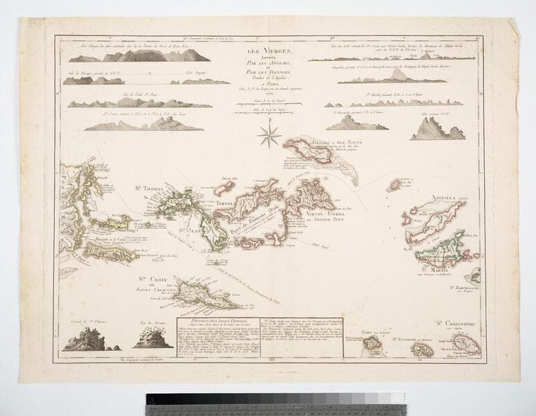
Daily: 10 A.M.–5 P.M.
Closed on Tuesdays
1151 Oxford Road
San Marino, CA 91108

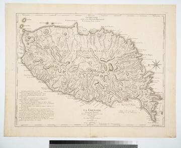
Visual Materials
Kashnor notes, "The second issue, noting that D';Estaing attacked Port Royal in 1779." Prime meridian: Ferro, London. Relief: hachures. Graphic Scale: Leagues. Projection: Plane. Watermark: Chained maltese cross lettering. Printing Process: Copper engraving. Verso Text: MS note: 402.
105:402 M
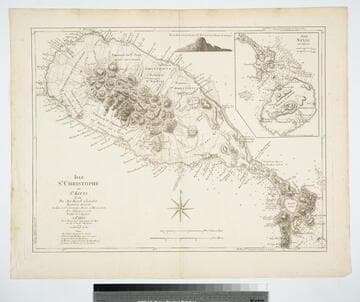
Visual Materials
Jefferys died before this map was supposedly made. Submap: Isle Nevis par Jefferys. Vignette: View of Nevis from 6 or 7 leagues.. "Par. Ant:Ravell Chevalier Arpenteur Général des Isles de St. Chrostophe, Nevis et Montserrat." "Par Jefferys en 1775, Traduit de l'Anglais." Prime meridian: London. Relief: hachures. Graphic Scale: Miles, leagues. Projection: Plane. Watermark: Chained maltese cross lettering. Printing Process: Copper engraving. Other Features: VignettesSub-maps. Verso Text: MS note: 776.
105:776 M
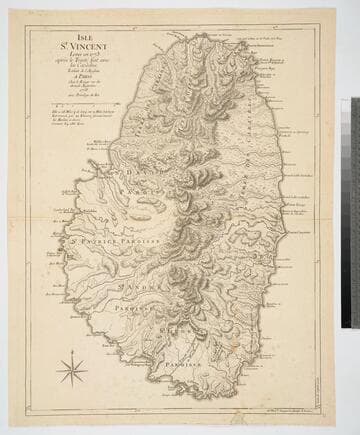
Visual Materials
Kashnor notes, "A good map by le Rouge (after Jefferys)." Prime meridian: London. Relief: hachures. Graphic Scale: Miles. Projection: Cylindrical. Watermark: Chained maltese cross lettering. Printing Process: Copper engraving. Verso Text: MS note: 832.
093:832 M
![Carte de la Floride Occidentale et Louisiane - La Peninsule at Golfe de la Floride ou Canal de Bahama avec les Isles de Bahama [two maps in one]](/_next/image?url=https%3A%2F%2Frail.huntington.org%2FIIIF3%2FImage%2F22APN4KVPDMF%2Ffull%2F%5E360%2C%2F0%2Fdefault.jpg&w=750&q=75)
Visual Materials
Kashnor notes, "Copied from Jefferys' fine chart, the best chart of the time for navigators to Florida and the Mississippi. This was issued for the use of French allies during the Revolution." Appeared in reference from RLIN record. Compass rose. Ships on two routes.. Prime meridian: London, Ferro. Relief: pictorial. Graphic Scale: No. Projection: Mercator. Watermark: Chained Maltese cross lettering. Printing Process: Copper engraving. Other Features: Art Work. Verso Text: MS notes: 28 29 98.
105:098 M

Visual Materials
Kashnor notes, "A scarce French map, showing the roads and plantations, showing the names of the planters." Two views of the island. Compass rose.. Prime meridian: London. Relief: hachures. Graphic Scale: Miles, leagues. Projection: Oval. Watermark: Chained Maltese cross lettering. Printing Process: Copper engraving. Other Features: Vignettes. Verso Text: MS note: 170.
105:170 M
Image not available
Visual Materials
Submap: Isles Marianes ou Des Ladrons. Cartouche: decorative.. "Guill. Delahaye sculp." Prime meridian: Ferro. Relief: pictorial. Graphic Scale: Miles, leagues. Projection: Pseudocylindrical. Watermark: Five sided device lettering. Printing Process: Copper engraving. Other Features: Sub-mapsCartouche.
105:731 M