Visual Materials
A New Map of North America from the Latest Discoveries. 1763
You might also be interested in
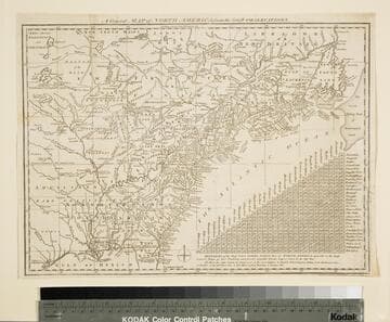
General Map of North America from the Latest Observations
Visual Materials
Kashnor gives date as [1776] RLIN record suggests 1778. Map includes distance chart between 29 American and Canadian cities. Bounds of Hudsons Bay [Co.] shown by Treaty of Utrecht. MS note: 102 (on backing). Prime meridian: London. Relief: pictorial. Projection: Mercator. Printing Process: Copper engraving. Verso Text: MS note: 1776.
105:102 S
Image not available
A New Map of North America, agreeable to the Latest Discoveries
Visual Materials
Kashnor notes, "Shows the Pacific Coast as it was known immediately before Vancouver's discoveries. It is a good map of the North West and Alaska." See also 105:267M for an apparent later version. Ms note: 266 (on backing). Prime meridian: London. Relief: pictorial. Projection: Conic. Watermark: 1794 Whatman. Printing Process: Copper engraving. Verso Text: MS note: 266.
105:266 S
Image not available
A New Map of North America, agreeable to the latest Discoveries
Visual Materials
Kashnor notes, "Shows New Albion, all the territory northward of the Missouri and Oregon as part of British Territory." This map appears to be a later edition of 105:266 by Wilkinson. It now shows Vancouver Island as Quadra and Vancouver's Island. New mountains appear in the west and the map extends further south. Kashnor dates as c. 1796. MS note: 267 (on Backing). Prime meridian: London. Relief: pictorial. Projection: Conic. Printing Process: Copper engraving.
105:267 S

New Map of North America from the Latest Authorities
Visual Materials
Kashnor notes, "In Baffin's Bay appears the following note: 'This bay is considered doubtful beyond Sanderson's Hope.' A very fine map showing the coastline to the North-West and Alaska, locating San Francisco, Monterey, and the old Spanish settlements of California. It is one of the earliest maps, published in England, that locates the Columbia River under that name." Prime meridian: London. Relief: pictorial. Graphic Scale: No. Projection: Mercator. Printing Process: Copper engraving. Verso Text: Ms notes: H 45.
105:045 M
Image not available
A New Map of South America, Drawn from the latest Discoveries
Visual Materials
Kashnor dates as ca. 1800. MS note: 852 (on backing). Prime meridian: London. Relief: pictorial. Projection: Pseudocylindrical. Printing Process: Copper engraving.
105:852 S
Image not available
North America
Visual Materials
Kashnor notes, "Shows a good coast-line of the North-West Coast, locating Fort St. Francisco, New Albion and the Columbia River." Vignette of Ft. Niagara from the British Light House. View of Ft. Niagara from British Light House.. Prime meridian: GM. Relief: pictorial. Graphic Scale: Miles. Projection: Pseudocylindrical. Printing Process: Etching. Other Features: Vignettes. Verso Text: MS note: 200 (on backing).
093:200 S