Visual Materials
A New Map of North America, agreeable to the latest Discoveries
You might also be interested in
Image not available
A New Map of North America, agreeable to the Latest Discoveries
Visual Materials
Kashnor notes, "Shows the Pacific Coast as it was known immediately before Vancouver's discoveries. It is a good map of the North West and Alaska." See also 105:267M for an apparent later version. Ms note: 266 (on backing). Prime meridian: London. Relief: pictorial. Projection: Conic. Watermark: 1794 Whatman. Printing Process: Copper engraving. Verso Text: MS note: 266.
105:266 S
Image not available
A New Map of North America from the Latest Discoveries. 1763
Visual Materials
Kashnor notes, "A good map of the far west to the Lake of the Woods, and locating Fort St. Charles and Fort St. Pierre. Shows the old boundaries of Carolina, Virginia, and New England reaching beyond the Mississippi." MS note: 524 (on backing). Prime meridian: London. Relief: pictorial. Projection: Mercator. Printing Process: Copper engraving.
105:524 S

New Map of the British Empire in North America, Drawn from the latest Authorities
Visual Materials
Kashnor notes, "Showing the coast south to Florida, and the territories north-west of Lake of the Woods and Louisiana. A scarce map issued during the Revolution." On distinctive blue-gray paper often used by Kitchin. Millar's Geography was rushed to print in 1775 at start of American Revolution. Tip of Florida shown in submap. Cartouche shows natives bowing to Britannia.. Prime meridian: London. Relief: pictorial. Graphic Scale: Miles. Projection: Pseudocylindrical. Printing Process: Copper engraving. Other Features: Sub-mapsCartouche. References: McCorkel 782.10. Verso Text: MS note: 116.
105:116 S

A New Map of the United States of America, From the Latest Authorities by John Cary, Engraver. 1806
Visual Materials
Kashnor notes, "Shows valuable map of the Western Territory as far north as Lake of the Woods, including the Ohio, Illinois, Michigan and Wisconsin Territories of the present day." Prime meridian: GM. Relief: pictorial. Graphic Scale: Miles, leagues. Projection: Pseudocylindrical. Printing Process: Copper engraving. Verso Text: MS note: 639.
105:639 M

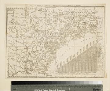
General Map of North America from the Latest Observations
Visual Materials
Kashnor gives date as [1776] RLIN record suggests 1778. Map includes distance chart between 29 American and Canadian cities. Bounds of Hudsons Bay [Co.] shown by Treaty of Utrecht. MS note: 102 (on backing). Prime meridian: London. Relief: pictorial. Projection: Mercator. Printing Process: Copper engraving. Verso Text: MS note: 1776.
105:102 S
Image not available
A New Map of South America, Drawn from the latest Discoveries
Visual Materials
Kashnor dates as ca. 1800. MS note: 852 (on backing). Prime meridian: London. Relief: pictorial. Projection: Pseudocylindrical. Printing Process: Copper engraving.
105:852 S