Rare Books
Chart of the Atlantic Ocean, with the British, French & Spanish Settlements in North America and the West Indies; and also on the Coast of Africa / by Thos. Jeffreys Geographer to His Majesty
You might also be interested in

Chart of the Atlantic Ocean, with the British, French & Spanish Settlements in North America and the West Indies; as also on the Coast of Africa
Visual Materials
Kashnor notes, "Shows the old boundaries of Carolina and Virginia, with the coast from Hudson's Straits to the Amazon." Shows false "New Discovered Sea" east of Hudson's Bay. Latitude and longitude observations from several sources compared in tabular form. Kashnor dates as [1775]. Latitude and longitude tables.. Prime meridian: Ferro. Relief: pictorial. Projection: Mercator. Printing Process: Copper engraving. Verso Text: MS note: 161.
105:161 M
Image not available
The West Indies : exhibiting the English, French, Spanish, Dutch & Danish settlements collected from the best authorities / by Thomas Jefferys, Geographer to the King
Rare Books
Pieced together from two separate sheets; the sheet on the right that appeared in The natural and civil history of the French dominions in North and South America by Thomas Jefferys, 1760, volume 2; page 1 (RB 148808). Cartouche: flowered. Prime meridian: London, Ferro. Relief: pictorial. Graphic Scale: Miles, Leagues. Projection: Pseudocylindrical. Printing Process: Copper engraving.
480571
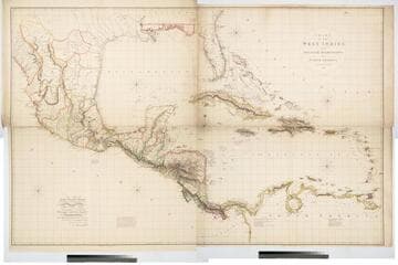
Chart of the West Indies and Spanish Dominions in North America. By A. Arrowsmith 1803
Visual Materials
Kashnor notes, "Amongst other interesting particulars, this map indicates the positions of the canals proposed to be cut by the Spaniards in 1528. The original issue of Arrowsmith's map, valuable for the detail regarding the coast of present-day Texas and the colonies of New Santander." " Jones Smith & Co. sc. Beaufort Build'gs Strand." "To Admiral John Willett Payne, A distinguished Native of the West Indies. Vice Admiral of the Coasts of Devonshire & Cornwall, Treasurer of Greenwich Hospital, Comptroller General of the Household of the Prince, &c., &c., &c. This chart is respectfully Dedicated by his most obedient Serv't A. Arrowsmith." Prime meridian: London. Relief: hachures. Projection: Cylindrical. Printing Process: Copper engraving. Verso Text: MS note: 795.
105:795 M
Image not available
Map of the British Empire in America with the French and Spanish Settlements adjacent thereto by Hen. Popple
Visual Materials
Kashnor notes, "This is Popple's key map, with the rare inset view of New York. It is seldom that a colored copy occurs for sale." Kashnor dates as [1733]. Rosenthal confirms this as the index map for the 20 sheet Popple Atlas map published in 1733. Contain a quote from Edmond Halley praising Popple's map, several views. "Price 2 Shills." "W. H. Toms sculp." "To the Queen's most Excellent Majesty This Map is most humbly inscribed by Your Majesty's most Obedient and Most Humble Servant Henry Popple." Cartouche: Indians. Vignettes: Niagra Falls, Mexico City, Quebec City, New York City. Ships & sea battle. Submaps: Seventeen thumbnail maps of ports.. Prime meridian: London. Relief: pictorial. Projection: Mercator. Printing Process: Copper engraving. Other Features: CartoucheVignettesSub-maps. Verso Text: MS note: 583.
105:583 M
Image not available
North America From the French of Mr. D'Anville Improved with the Back Settlements of Virginia and Course of Ohio Illustrated with Geographical and Historical Remarks
Visual Materials
Kashnor notes, " 'Canada, & the French Incroachments are distinguished by Yellow; the Spanish Settlements by Green; and the English Colonies by other Colours.' There is a long note on the history of the French encroachment, and the aggressive French forts are clearly indicated. The map was issued to counteract the assertions of the French Memorial which had been circulated to prove the justification for the encroachments." Classic cartouche. Much text on territorial claims.. Prime meridian: London, Ferro. Relief: pictorial. Graphic Scale: Miles, Leagues. Projection: Pseudocylindrical. Printing Process: Copper engraving. Other Features: Cartouche. Verso Text: MS note: 670.
105:670 M

United States of North America, with the British & Spanish Territories according to the Treaty
Visual Materials
Kashnor notes, "Similar to Faden's map of "The British Colonies in North America," with the addition of colored contours indicative of the British, Spanish, French and American frontiers." See 093:544, 093:545 for later copies. Cartouche of Caribbean traders.. Prime meridian: London. Relief: pictorial. Projection: Pseudocylindrical. Watermark: Crowned fluer-di-lis VI. Printing Process: Copper engraving. Other Features: Cartouche. Verso Text: MS notes : 105 148.
105:148 M