Rare Books
Map of the Comstock Brunswick and Flowery Lodes : showing the mining claims embraced in Virginia, Gold Hill, Devils Gate and Chinatown, Silver Star, American Flat and Flowery Districts. Lyon and Storey Counties Nevada 1923

You might also be interested in
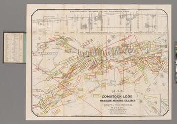
Map of the Comstock Lode and the Washoe Mining Claims in Storey & Lyon Counties, Nevada / Compiled from Official Surveys and other reliable data by T. D. Parkinson, C.E
Rare Books
Longitudinal Section of the Comstock Lode. Prime meridian: GM. Relief: hachures. Graphic Scale: Feet. Projection: Plane. Printing Process: Lithography. Verso Text: MS note: 240738.
240738
Image not available
Map of Virginia City and the Comstock Lode State of Nevada, showing the latest changes up to Jan 1st 1875. Compiled and drawn by Edw. B. LaSalle, Topog. Engineer. 1875
Rare Books
Prime meridian: GM. Relief: hachures. Graphic Scale: Feet. Projection: Plane. Printing Process: Lithography.
245584
Image not available
Map of Virginia, Gold Hill, Devils Gate, American Flat, gold & silver mining districts : state of Nevada / Higginson & Goldsworthy, Civil & Mining Engineers. Silver City, Nevada
Rare Books
Alt. title from cover. Prime meridian: GM. Relief: hachures. Graphic Scale: Chains. Projection: Cylindrical. Printing Process: Lithography.
41396
Image not available
Plan of the Battle of Brandywine. September 11th 1777 Compiled from the actual Survey made during the summer of 1846
Rare Books
Prime meridian: GM. Relief: hachures. Graphic Scale: Feet, miles. Projection: Plane. Printing Process: Lithography.
252166
Image not available
Map of the Gold Hill Front Lodes on the Comstock Range N. T. Surveyed July 1864. by N. Wescoatt, C.E. Located Sept. & Oct. 1859. Made to accompany Report of Dr. J. A. Veatch. Attenh. N. Wescoatt, C.E
Rare Books
Folder also contains "Statement and Reports concerning the Uncle Sam Senior and Gold Canon Silver Lodes, in Nevada. 1865" Prime meridian: GM. Relief: hachures. Graphic Scale: Feet. Projection: Plane. Printing Process: Lithography.
254347
Image not available
Map of Los Angeles City and Western Additions, California : compiled from records of private surveys, records on file in City Engineer's Office, and records on file in Office of County Recorder / By Theo. G. Koeberle and John A. Morton, Civil Engineers and Surveyors
Rare Books
Cracking along bottom line, careful. Prime meridian: GM. Relief: hachures. Graphic Scale: Feet. Projection: Plane. Printing Process: Lithography.
273834