Visual Materials
North America
You might also be interested in
Image not available
Map of that part of America which was the Principal Seat of War. in 1756
Visual Materials
Kashnor notes, "Nova Scotia to Massachusetts, and westward to Lake Ontario and the St. Lawrence." Kashnor dates as ca. 1760. RLIN record suggests printing date of 1757. MS note: 661 (on backing). Prime meridian: London. Relief: pictorial. Graphic Scale: Miles, leagues. Projection: Pseudocylindrical. Printing Process: Copper engraving.
105:661 S
Image not available
North America
Visual Materials
Kashnor notes, "Locates San Francisco, Monterey, Santa Barbara, and New Helvetia, shows the Oregon boundary, and east of the Rockies is called Missouri Territory." Nine scenes or vignettes around the outside of map image. Kashnor dates as ca. 1846. RLIN record suggests 1850 date. Nine hand colored figures and scenes by J. Marchant, engraved by J. Rogers: Cossacks, Esquimaux, Mount Hecla, Wapiti Deer, Beavers, North American Indians, Falls of Niagara, Ancient Mexican Monument and a Convoy of Diamonds. Elaborate Victorian border. MS note: 274 (on backing).. Prime meridian: GM. Relief: hachures. Projection: Conic. Printing Process: Engraving. Other Features: Figures Art Work. Verso Text: MS note: 274.
105:274 S

Plan of the City and Environs of New York in North America
Visual Materials
Kashnor dates as circa. 1776. Place and appeared in from RLIN record. Colorful map. MS note: 128 (on backing). Relief: hachures. Graphic Scale: Feet. Projection: Plane. Watermark: Seal Crowned CR lettering. Printing Process: Copper engraving. Other Features: Art Work.
105:128 S

A new and accurate map of New Jersey, from the best authorities
Visual Materials
RLIN reference gives author, place of production, and notes this map is from Universal Magazine, v. 66, June 1780. Kashnor dates as circa 1780. MS note: 113 (on backing). Prime meridian: London. Relief: pictorial. Projection: Mercator. Watermark: Seal. Printing Process: Copper engraving.
105:113 S
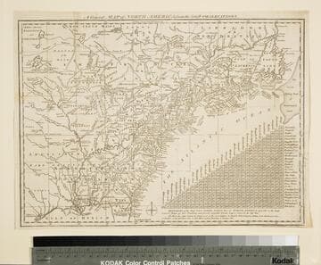
General Map of North America from the Latest Observations
Visual Materials
Kashnor gives date as [1776] RLIN record suggests 1778. Map includes distance chart between 29 American and Canadian cities. Bounds of Hudsons Bay [Co.] shown by Treaty of Utrecht. MS note: 102 (on backing). Prime meridian: London. Relief: pictorial. Projection: Mercator. Printing Process: Copper engraving. Verso Text: MS note: 1776.
105:102 S

New and Accurate Map of the Province of South Carolina in North America
Visual Materials
Appears to be from same source as 093:094S. RLIN record gives dates and location of publication with question marks. MS note: 77 (on backing). Prime meridian: London. Relief: pictorial. Graphic Scale: Miles. Projection: Cylindrical. Watermark: Intricate seal. Printing Process: Copper engraving.
105:077 S