Opening Hours
Daily: 10 A.M.–5 P.M.
Closed on Tuesdays
1151 Oxford Road
San Marino, CA 91108
Visual Materials
Daily: 10 A.M.–5 P.M.
Closed on Tuesdays
1151 Oxford Road
San Marino, CA 91108

Image not available
Visual Materials
Kashnor notes, "Shows the Californian coast to Cape Blanco, locating Pte. S. Francois Drak, Monterey, etc.; also Santa Fe in New Mexico." Kashnor dates as ca. 1760. MS note: CA. Prime meridian: Ferro. Relief: pictorial. Graphic Scale: Miles, leagues. Projection: Pseudocylindrical. Printing Process: Copper engraving. Verso Text: MS note: 205.
093:205 M
Image not available
Visual Materials
Kashnor notes, "Carries the western coast no further north than Cape Blanco, but locates Pto. de Francisco Draco and Monte Rey, also Santa Fe in New Mexico." This is an updated and smaller version of Jaillot's 1692 map (093:161M) now showing California as a peninsula. Prime meridian: Ferro. Relief: pictorial. Graphic Scale: Miles, leagues. Projection: Pseudocylindrical. Watermark: Chained Maltese cross lettering. Printing Process: Copper engraving. Other Features: Cartouche.
105:206 M
Image not available
Visual Materials
Kashnor notes, "Shows California as a peninsula, and locates Port St. Francois and the coast to Cape Blanco. Delisle appears to be the earliest map maker to show California with a definite coastline." See also 105:231M. Prime meridian: Ferro. Relief: pictorial. Projection: Conic. Watermark: Chained Maltese cross lettering. Printing Process: Copper engraving. Verso Text: MS notes: Delisle Hemisphere Septentrional.
105:230 M

Visual Materials
Kashnor notes, " Indicates the location of the Indian nations and the French forts, especially those taken from the Hudson's Bay Company. It locates the wintering place, on the Bay, of Jean Munck in 1619. This is one of the earliest issues of Delisle's map." See also 105:431, 105:432 for later versions. Cartouche with natives.. Prime meridian: Ferro?. Relief: pictorial. Graphic Scale: Miles, leagues. Projection: Pseudocylindrical. Watermark: Chained Maltese cross lettering. Printing Process: Copper engraving. Other Features: Cartouche. References: McCorkle 703.5. Verso Text: MS notes: 432.
105:433 M
Visual Materials
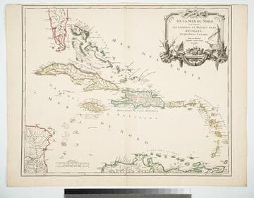
Cartouche: Ships & shells.. "Guill. Delahaye Sculpsit." Prime meridian: Ferro. Relief: pictorial. Graphic Scale: Leagues, miles. Projection: Cylindrical. Watermark: Chained maltese cross lettering. Printing Process: Copper engraving. Other Features: Cartouche. Verso Text: MS notes: 969 Islers Antilles 107.
105:969 M
Visual Materials
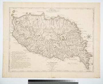
Kashnor notes, "The second issue, noting that D';Estaing attacked Port Royal in 1779." Prime meridian: Ferro, London. Relief: hachures. Graphic Scale: Leagues. Projection: Plane. Watermark: Chained maltese cross lettering. Printing Process: Copper engraving. Verso Text: MS note: 402.
105:402 M