Visual Materials
Pacific Palisades looking up to Topanga

You might also be interested in

Bird's-eye-view of coastline, Pacific Palisades, California
Visual Materials
Image of a bird's-eye-view of the beach, mountains, and coastline along the Santa Monica Bay, with the Bel-Air Bay Club buildings visible at center, with the lower clubhouse on the beach and the upper clubhouse in the hills, as seen from Pacific Palisades, California, looking north towards Malibu.
photCL_555_06_2562

Trancas Canyon, Highway 101, Rancho Malibu
Visual Materials
Image of the coastline looking south towards Point Dume, Roosevelt Highway (later Pacific Coast Highway), and beach houses along Broad Beach near Trancas Canyon at Rancho Malibu, California, with a cafe and billboard visible.
photCL_555_06_2013

View from the bluff looking down on the beach, Santa Monica
Visual Materials
Image from the bluff looking down on the beach and automobiles on Pacific Coast Highway in Santa Monica, California, with the bluffs and Palisades Park visible at left.
photCL_555_06_2599

Bicycle race on coast highway, Pacific Palisades
Visual Materials
Image of a crowd of people standing alongside the Roosevelt Highway (later Pacific Coast Highway) watching a cyclist in a bicycle race while he rides by in Pacific Palisades, California, with cars parked up along Porto Marina Way at right, and the Villa de Leon mansion at 17948 Porto Marina Way visible in the background on the hill.
photCL_555_09_98

Palisades Beach Road, Santa Monica
Visual Materials
Elevated view of houses along the beach in Santa Monica, California, looking south from the bluffs of Palisades Park, with railroad tracks and the Palisades Beach Road (part of the Roosevelt Highway, later Pacific Coast Highway), below, and the Santa Monica Pier and Ocean Park Pier visible in the distance. The mansion beach house of actress Marion Davies (which later became the Ocean House, or Oceanhouse hotel, and Sand and Sea Beach Club) is visible with multiple fireplaces in the foreground.
photCL_555_06_2551
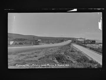
Highway 101 - Midway Santa Monica to Oxnard, Calif
Visual Materials
Image of the coastline looking south towards Point Dume from the Roosevelt Highway (later Pacific Coast Highway), and beach houses along Broad Beach near Trancas Canyon at Rancho Malibu, California, with the Malibu Trading Post, Cafe, cafe, Gilmore gas station, and a "Malibu Beaches" billboard visible.
photCL_555_06_2042