Opening Hours
Daily: 10 A.M.–5 P.M.
Closed on Tuesdays
1151 Oxford Road
San Marino, CA 91108
Daily: 10 A.M.–5 P.M.
Closed on Tuesdays
1151 Oxford Road
San Marino, CA 91108

Visual Materials
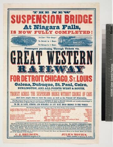
Image of a broadside with promotional text for the Great Western Railway and statistics about the Niagara Falls Suspension Bridge, with a wood-engraved vignette of a steam locomotive train crossing the bridge in the upper left, and a wood engraved vignette of a steam locomotive passenger train in a mountainous region in the upper right.
priJLC_TRAN_001150
Visual Materials
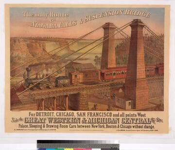
Image of an elevated landscape view of a steam locomotive and passenger train with baggage and sleeping cars crossing the Niagara Falls Suspension Bridge between the bridge towers on the New York side of the gorge; with pedestrians and a horse-drawn carriage below the bridge and Witmer's Mill behind it, and Niagara Falls, the banks, and the covered enclosure of an incline railway in the distance; the locomotive has a 4-4-0 wheel arrangement and the cab and tender are labeled "207."
priJLC_TRAN_001068
Visual Materials
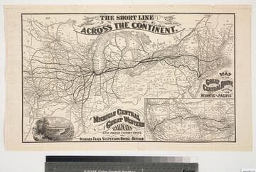
Image of a map of a portion of the Eastern United States from as far west as Omaha, Nebraska, showing railroad routes of the Michigan Central and Great Western Railroad and connecting lines, with a vignette in the lower left corner of the Niagara Falls Suspension Bridge and an inset map in the lower right corner of the Western United States showing railroad routes and titled, "Map between the Missouri River and the Pacific Ocean"; map verso contains panels with the fold-up map covers, promotional descriptions including an image of a freight car for the Great Central Route's Blue Line, and timetables.
priJLC_TRAN_001174
![Sketch of the Niagara Falls suspension bridge : (new in progress) shewing [sic] the basket ferry and the temporary towers of the foot bridge](/_next/image?url=https%3A%2F%2Frail.huntington.org%2FIIIF3%2FImage%2F22APN42PIBK2%2Ffull%2F%5E360%2C%2F0%2Fdefault.jpg&w=750&q=75)
Visual Materials
Image of an eye-level landscape view of the Niagara Falls gorge, showing the cable lines and ferry basket that were strung across the Niagara River during the construction Niagara Falls Suspension Bridge connecting New York and Ontario, Canada, with towers and a man on the banks in the foreground, and the waterfall in the distance; section view of cable in ferry and bridge statistics printed in bottom margin.
priJLC_VIEW_000730
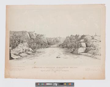
Visual Materials
Image of an elevated landscape view of a suspension bridge across the gorge between Lewiston, New York, and Ontario, Canada, as seen from the Niagara River, and showing winding roads with pedestrians and horses leading into the mountains on both sides, and boats and a steamboat ferry in the water; bridge details printed in bottom margin.
priJLC_VIEW_000727
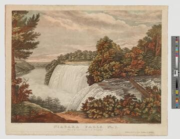
Visual Materials
Image of a landscape view of Niagara Falls American waterfall from Goat Island in New York; bridge over the river visible at right.
priJLC_VIEW_004018