Opening Hours
Daily: 10 A.M.–5 P.M.
Closed on Tuesdays
1151 Oxford Road
San Marino, CA 91108
Daily: 10 A.M.–5 P.M.
Closed on Tuesdays
1151 Oxford Road
San Marino, CA 91108

Rare Books
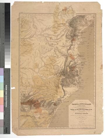
Kirkpatrick Catalogue entry: "2477 Schultz, W. Mappa da Provincia de Santa Catharina do Imperio do Brasil com as partes adjacentes das Provicncias do Parana e de São Pedro do Rio Grande do Sul. Leipzig, Instituto lithographico de F. A. Brockhaus, 1863. 1 sheet. [see cabinet]."Probably obtained while Burton was in South America between 1865 and 1868. MS notes: Burton (map cabinet) Schultz Mappa 2477. Prime meridian: GM. Relief: hachures. Graphic Scale: Leagues. Projection: Polyconic. Printing Process: Lithography.
623651

Rare Books
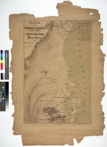
Kirkpatrick Catalogue entry: "2478 [Schultz, W.] Planta das colonias allemães e terrenos medidos na Provincia de Santa Catharina. Lipsia, Instituto lithographico de H. Kunsch, 1861. 1 sheet. [see cabinet]." Probably obtained while Burton was in South America between 1865 and 1868. Prime meridian: GM. Relief: hachures. Graphic Scale: Leagues. Projection: Plane. Printing Process: Lithography.
623652

Rare Books
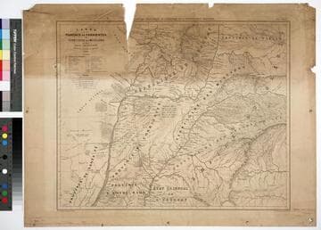
Kirkpatrick Catalogue entry: "2473 l [Moussy, V. M. de.] Carte de Province de Corrientes du territoire des missions et des pays adjacents. Paris, Imp. Lemercier, 1865. 1 sheet [see cabinet]."Fragile, in pieces. MS note in lower left corner. Probably obtained while Burton was in South America between 1865 and 1868. MS notes: 3eme E--- 24 M-- 1865. Burton (map cabinet) 2443 Moussy. Prime meridian: GM. Relief: hachures. Graphic Scale: Miles, leagues. Projection: Polyconic. Printing Process: Lithography.
623647

Rare Books
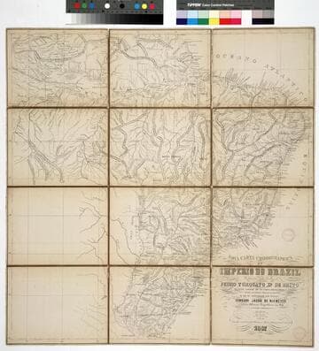
Kirkpatrick Catalogue entry: "2475 Niemeyer, C. J. de Nova carta chorographica do Imperio do Brazil ...1856. [Rio de Janeiro], Gravada na Litha. do Archo. Militar por Alvaro e Pereira, 1867. 1 sheet. [see p.]."MS label on verso reads "Coronel Niemeyer's Map of Brazil." Probably obtained while Burton was in South America between 1865 and 1868. Prime meridian: Rio de Janeiro. Relief: hachures. Graphic Scale: Leagues, kilometers. Projection: Cylindrical. Printing Process: Lithography. Verso Text: Label: Coronel Niemeyer's Map of Brazil. Stamp: Kensington Public Libraries.
623649

Rare Books
Kirkpatrick Catalogue entry: "2468 Laemmert, E. & H., publisher. Nova planta de ciudad do Rio de Janeiro. [Rio de Janeiro], 1864. 1 sheet. [see p.]." Publishers sticker inside front cover. The legend to the left of and below the map lest different squares, streets, public buildings, etc. Probably obtained while Burton was in South America between 1865 and 1868. Street and building index in surround.. Prime meridian: GM. Relief: hachures. Projection: Plane. Printing Process: Lithography. Verso Text: Stamps: Kensington Public Libraries.
623641

Rare Books
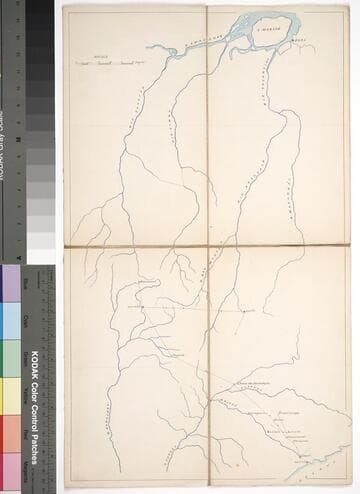
Kirkpatrick Catalogue entry: "2460 Brazil. [Mail route from São Paulo. n.p., 18--]. 1 sheet (holograph). [see p.]."Manuscript map? Map is untitled except for an ms sticker on the verso which reads "Mail route." Para, the northernmost city on the map, is now referred to as Belem. The distance between Belem and São Paulo is around 3000 kilometers. The farthest that the route goes from São Paulo is Diamantino in the state of Mato Grosso, a distance of about 1800 kilometers. São Carlos was founded in 1857, the latest of any of the cities shown here. Probably obtained while Burton was in South America between 1865 and 1868. Relief: no. Graphic Scale: Leagues. Projection: Cylindrical. Printing Process: n/a. Verso Text: Sticker: Mail Route MS notes: p maps Brazil 2460.
623634