Rare Books
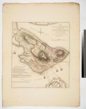
A Plan of the Battle on Bunkers Hill, Fought on the 17th of June 1775, by an Officer on the Spot
- Description
- This map includes a description of the action written by General Burgoyne to his nephew Lord Stanley. He makes significant the charge that the British set Charlestown on fire on purpose. He also notes "Hither the ships ought to have come" where they could have commanded the neck of land where the American forces escaped after the final British charge up the hill. He lists notable deaths and injuries suffered by the British forces. Prime meridian: GM. Relief: hachures. Graphic Scale: Miles. Projection: Plane. Watermark: Fleur-de-lis on shield GP. Printing Process: Copper engraving.
- Date
- 27 November 1775
- Call number
- 295807

![Seat of the War, in New England, by an American Volunteer [Submap]: Plan of the Town of Boston with the Attack on Bunkers-Hill in the Peninsula of Charlestown, the 17th. of June 1775. With the Marches of the Several Corps Sent by the Colonies. Towards Boston. with the Attack on Bunkers = Hill](/_next/image?url=https%3A%2F%2Frail.huntington.org%2FIIIF3%2FImage%2F22APN4KOYJI7%2Ffull%2F%5E360%2C%2F0%2Fdefault.jpg&w=750&q=75)