Rare Books
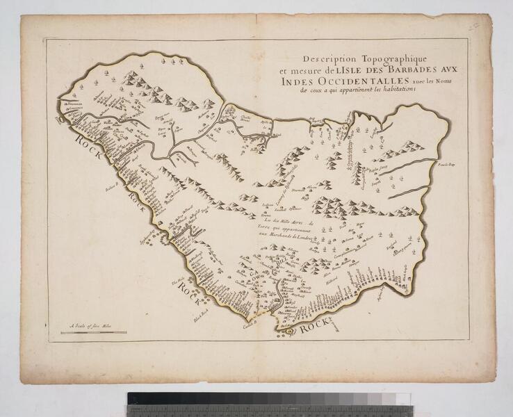
Description Topographique et mesure de l'isle des Barbades aux Indes Occidentalles avec les Noms de ceux a qui appartienent les habitations
Rare Books
Daily: 10 A.M.–5 P.M.
Closed on Tuesdays
1151 Oxford Road
San Marino, CA 91108

Rare Books
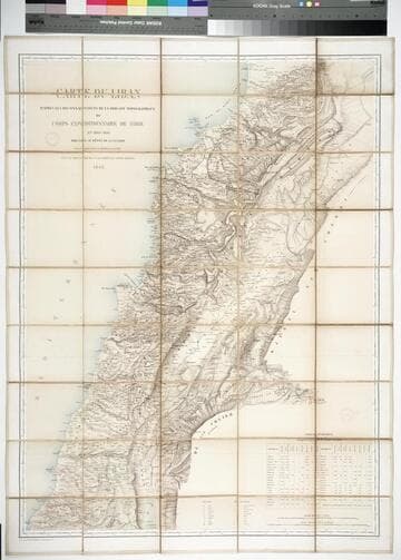
Kirkpatrick Catalogue entry: "2483 Blondel, L. A. Carte du Liban d'après les reconnaissances de la Brigade topographique du Corps expéditionnaire de Syrie en 1860-1861, dressée au Dépôt de la Guerre ... Paris, Imp. Lemercier, 1862. 1 sheet. [see p.]."Statistical table in the bottom right gives population of the major towns and cities in Lebanon by religion. Case which previously held the map gives alternate title, and the bookseller in Beirut who sold the map. Label on case reads "Charlier-Béziès Beyrouth Librairie Commission Articles divers." Population table. Stamp: Kensington Public Libraries. Prime meridian: Paris. Relief: hachures. Graphic Scale: Kilometers, leagues. Projection: Cylindrical. Printing Process: Lithography. Verso Text: Stamps: Kensington Public Libraries.
623657
Image not available
Rare Books
See 093:159M for an earlier version of this map. MS note: "Born in 1675" ; "Died in 1726" - on either side of L'Isle's name. Cartouche: Mermen. Prime meridian: Ferro. Relief: pictorial. Graphic Scale: Leagues, various. Projection: Pseudocylindrical. Watermark: Lettering. Printing Process: Copper engraving. Verso Text: MS notes: l'Amerique Septentrionale 93:160 [erased].
291456
Image not available
Visual Materials
Famous de l'Isle map with South America curving west. See 093:631 for Sanson's copy of this map. Cartouche: Figures & scrolling.. Prime meridian: Ferro. Relief: pictorial. Graphic Scale: Leagues. Projection: Pseudocylindrical. Watermark: Chained maltese cross. Printing Process: Copper engraving. Other Features: Cartouche. Verso Text: MS notes: 610 29.
093:610 M
Image not available
Visual Materials
Kashnor notes, "According to the draughtsman the Popple map was not in the proper latitude." Actually, it is a longitude error Buache is referring to. Buache has a long history of designing similar maps to show up errors of other mapmakers and enhance his own position. His map is printed in blue as an overlay of the Popple map printed in red. An early dual printed map. MS note: 252. Prime meridian: Ferro. Relief: no. Projection: Mercator. Watermark: Lettering. Printing Process: Copper engraving. Verso Text: MS note: 252 CDO (?).
093:252 S
Image not available
Rare Books
Kashnor notes, "... An important and scarce map of Ksmtschatka and Russian America, with the tracks of the explorers." [contains also Swartz letter of 13 January, 1740 in French and Dutch] "Rectifier selon la Carte de Monsieur Jean Kyrilow, premier Secretaire du Consiel de l'Empire de Russie publier en l'Anne 1734 ou on trouve le Pais de Kamschatka, d'ou le Captaine Spanberg a fait voile, comme la copie de Lettre si jointe par le Resident Hollandois Monsieur Swatrz a St. Petersbourg en fait mention." Prime meridian: Ferro. Relief: pictorial. Projection: Polar. Watermark: CS?. Printing Process: Copper engraving. Verso Text: MS notes: 4th N23/93 148972.
148973
Image not available
Visual Materials
Two maps on one sheet. Sailing chart. Kashnor states Paris as production site. Kershaw identifies this as the first state of Bellin's map and gives appeared in information. Three cartouches. Vignette: Vue de Terres du Sud pour passer la Traverse en remontant le Fleuve.. Relief: pictorial & hachures. Graphic Scale: Leagues. Projection: Plane. Watermark: Crowned birds J. Sauvade au Veron. Printing Process: Copper engraving. Other Features: CartoucheVignettesSub-maps. References: Kershaw 650. Verso Text: MS note: 354.
093:354 M