Opening Hours
Daily: 10 A.M.–5 P.M.
Closed on Tuesdays
1151 Oxford Road
San Marino, CA 91108
Visual Materials
Daily: 10 A.M.–5 P.M.
Closed on Tuesdays
1151 Oxford Road
San Marino, CA 91108

Image not available
Visual Materials
This is Sanson's version of famous de l'Isle map with South America curving west. See 093:610 or RB 295821. Kashnor dates as ca. 1680, but de l'Isle's map preceded this one. Kashnor notes, "Shows the Argentine provinces as "Provinces de Rio de la Plata." Cartouche: Figures & scrolling. MS note: No. 1 (upper left). Prime meridian: Ferro. Relief: pictorial. Graphic Scale: Leagues. Projection: Pseudocylindrical. Printing Process: Copper engraving. Verso Text: MS notes: 631.
093:631 M
Visual Materials
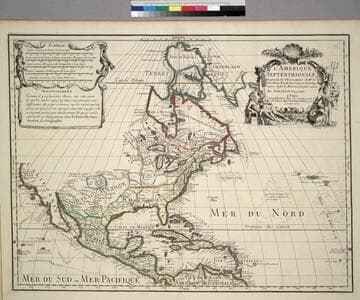
Kashnor notes, " Shows the Gulf of California reaching only as far north as the Bona Guia River, the north-west coast has its limit at Cap Mendocin. It locates the Sierra Nevada Mountains, Port de Drak and New Albion, and also the tracks of Cortez, Drake, Olivier, Mendana and Gaetana. One of the best maps to show the geographical knowledge of California at the beginning of the 18th century." George Carhart of Osher Map Library confirms this map to be state 2, published in [1701]. See 093:160M for a later version of this map. Cartouche and figured scale bar. Includes Avertissement.. Prime meridian: Ferro. Relief: pictorial. Graphic Scale: Leagues, various. Projection: Pseudocylindrical. Watermark: Chained Maltese cross. Printing Process: Copper engraving. Other Features: CartoucheFigures . Verso Text: MS notes: 72 (on folded left edge); 159 Mus. Bk St. 93/159 25.
093:159 M
Image not available
Visual Materials
Kashnor notes, "Shows the Argentine provinces as 'Provinces de Rio de la Plata'." [Shows l'Isle's 1700 version of this map with westward tilting South America.] See also 093:610M. Alt. title from upper margin. Cartouche: Natives. Prime meridian: Ferro. Relief: pictorial. Graphic Scale: Leagues. Projection: Pseudocylindrical. Printing Process: Copper engraving. Verso Text: MS note: 836.
105:836 M
Image not available
Visual Materials
Kashnor notes, "Locates the borders of La Plata, Uruguay, and Paraguay." This is a copy of Visscher's map, see 093:632. See also 093:634, 093:635 for other versions. RLIN record suggests print date is actually 1718. Cartouche: Figures.. Prime meridian: Ferro. Relief: pictorial. Graphic Scale: Leagues. Projection: Pseudocylindrical. Watermark: Chained maltese cross lettering. Printing Process: Copper engraving. Other Features: Cartouche. Verso Text: MS note: 633 3J.
093:633 M
Image not available
Rare Books
See 093:159M for an earlier version of this map. MS note: "Born in 1675" ; "Died in 1726" - on either side of L'Isle's name. Cartouche: Mermen. Prime meridian: Ferro. Relief: pictorial. Graphic Scale: Leagues, various. Projection: Pseudocylindrical. Watermark: Lettering. Printing Process: Copper engraving. Verso Text: MS notes: l'Amerique Septentrionale 93:160 [erased].
291456
Image not available
Visual Materials
Kashnor notes, "Shows the Gulf of California only reaching as high as the Bona Guia, but without the definite termination; also shows New Holland and part of New Zealand, with the tracks of Mendana, Dampier, Olivier, Tasman, Pelsart, Magellan and le Maire." Shirley shows this as first edition, 1700, note slant of South America's tip to the west. See also 093:181, 105:244 and 105:245 for later editions. Cartouche - figures representing four continents. Prime meridian: Ferro. Relief: pictorial. Projection: Dual Hemisphere. Watermark: Chained Maltese cross. Printing Process: Copper engraving. Other Features: Cartouche. References: Shirley 603. Verso Text: MS notes: 180 3.
093:180 M