Visual Materials
Map of the Countries Thirty Degrees Round the North Pole
You might also be interested in
Image not available
Map of the Countries Thirty Degrees Round the North Pole
Visual Materials
Kashnor notes, "Shows the Northern Coast of Alaska, and locates Mackenzie River and Hearne's Discoveries." Prime meridian: London. Relief: no. Graphic Scale: No. Projection: Polar. Printing Process: Copper engraving. Verso Text: MS note: 33.
105:033 S
Image not available
New and Accurate Map of North America, including the Nootka Sound, with the new Discovered Islands on the North East Coast of Asia
Visual Materials
Kashnor notes, "A good map of the North-West coast, Alaska and Kamtschatka, with the Nootkan and Californian Coast." Kashnor notes "ca. 1783." Map surface MS. notes: c 1790.; 44 Prime meridian: London. Relief: no. Graphic Scale: No. Projection: Pseudocylindrical. Printing Process: Copper engraving. Verso Text: MS. note: 44 (on backing).
093:044 S

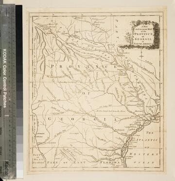
A new and accurate map of the province of Georgia in North America
Visual Materials
Kashnor notes, "Shows the old trading paths and the Hunting Grounds of the Cherokees." Kashnor dates c.1776. RLIN record notes date as [1779?] and place of publication as [London?] and as appearing in The Universal Magazine of 1779. See 093:391 and 105:103 for additional copies. MS note: 94 (on backing). Prime meridian: [Ferro]. Relief: pictorial. Projection: Cylindrical. Watermark: Crowned circular seal. Printing Process: Copper engraving. Other Features: Cartouche. Verso Text: MS note: 32 94(on backing).
093:094 S
Image not available
Map of America or the New World
Visual Materials
Kashnor notes, "Shows a fine coastline of the North-West and the Discoveries of Mackensie and Hearne." Cartouche with snake and wording "O Rare Columbus" in heavens above.. Prime meridian: Ferro. Relief: pictorial. Graphic Scale: No. Projection: Epicycloidal. Printing Process: Copper engraving. Other Features: Cartouche. References: Wagner 836. Verso Text: MS note: 32.
105:032 M
Image not available
New and Accurate Map of North America including Nootka Sound: with the new discovered Islands on the North East coast of Asia
Visual Materials
Kashnor notes, "A good map of the North-West Coast, Alaska and Kamtschatka, with the Nootkan and Californian Coast." Kashnor dates as ca. 1783. Lake Michigan is named Hinois L. Prime meridian: London. Relief: no. Graphic Scale: No. Projection: Pseudocylindrical. Printing Process: Copper engraving. Verso Text: MS note: 41.
105:041 S

Map of the Country round Philadelphia including part of New Jersey New York Staten Island & Long Island
Visual Materials
Kashnor notes, "a scarce war map." MS note: 121 (on backing). Prime meridian: London. Relief: pictorial. Graphic Scale: Miles, British Statute. Projection: Cylindrical. Watermark: Crowned seal. Printing Process: Copper engraving. Verso Text: MS note: 121 (on backing).
093:121 S