Opening Hours
Daily: 10 A.M.–5 P.M.
Closed on Tuesdays
1151 Oxford Road
San Marino, CA 91108
Rare Books
Daily: 10 A.M.–5 P.M.
Closed on Tuesdays
1151 Oxford Road
San Marino, CA 91108

Visual Materials
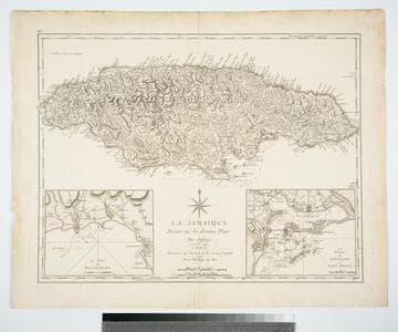
Two submaps. Submaps: Le Port de Bluefields; Les Ports de Kingston et Port Royal.. Prime meridian: London, Ferro. Relief: hachures. Graphic Scale: Miles. Projection: Cylindrical. Printing Process: Copper engraving. Other Features: Sub-maps. Verso Text: MS note: 457.
105:457 M
Visual Materials
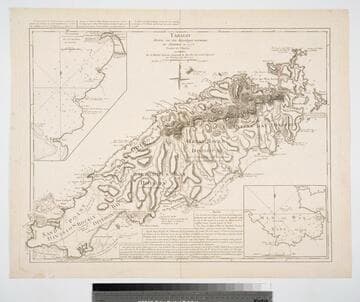
Submaps: Topographie, de la Grands et petite Baye de Courland; Man of War Baye.. Prime meridian: Ferro. Relief: hachures. Graphic Scale: Leagues. Projection: Cylindrical. Watermark: Chained maltese cross lettering. Printing Process: Copper engraving. Other Features: Sub-maps. Verso Text: MS note: 837.
093:837 M
Visual Materials
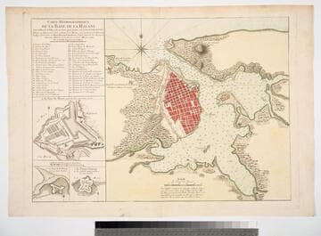
Submaps: Le Fort du Maure; Le Fort de la Pointe; Le Vieux Chateau.. Relief: hachures. Graphic Scale: Toises. Projection: Plane. Printing Process: Copper engraving. Other Features: Sub-maps. Verso Text: MS note: 750 40.
093:750 M
Image not available
Visual Materials
Kashnor notes, "The Darien map shows New Edinburgh and the Golden Island, each flying the flag of the Scots West India Company." Submaps: Rade de Darien et les Isles aux Environs; Carte de la Rade de Cartagene et des Environs &c.. Prime meridian: Paris. Relief: pictorial. Graphic Scale: Leagues. Projection: Cylindrical. Watermark: P symbol. Printing Process: Copper engraving. Other Features: Sub-maps. Verso Text: MS note: 689.
093:689 M
Image not available
Visual Materials
Possible duplicate of 105:854. Submaps: Entrance to the River Orinoco [with sailing directions];Map of the Orinoco River; Patagonia and Tierra del Fuego; Port of Angostura or St. Thome.. Prime meridian: GM. Relief: hachures. Graphic Scale: Miles. Projection: Cylindrical. Printing Process: Copper engraving. Other Features: Sub-maps. Verso Text: MS notes: 617 South America & section note..
093:617 M
Image not available
Visual Materials
Kashnor notes, "An exceedingly rare map of this colony, established about 10 leagues from Buenos Ayres." Submap: Parte de la Costa Septentrional del Rio de la Plata.. "Situada sobre la Costa Septentrional del Rio de la Plata. Demuestrase las Baterias, y ataques, que la pusieron los Espanoles el dia 1st Octobre del Ano de 1762, mandados por el Exmc. S. D. Pedro Cevallos, a quines se rindio a fines de dtho. mes y Ano. Por D. Tomas Lopez, Madrid, Ano de 1777." "Se hallara este con todes las Obras del Autor, en Madrid, en la Cale de las Carretas." Relief: hachures. Graphic Scale: varas, toesas. Projection: Plane. Watermark: BRVMEV. Printing Process: Copper engraving. Other Features: Sub-maps. Verso Text: MS note: 867.
105:867 M