Rare Books
Rare Books
Daily: 10 A.M.–5 P.M.
Closed on Tuesdays
1151 Oxford Road
San Marino, CA 91108

Image not available
Rare Books
This map shows the route of a visit by Lafayette. Also an elevation of the Erie Canal. Old folder dates [Paris, 1829] Submap: Section elevation of the Eire Canal. Window map sticker 712.. Prime meridian: Washington. Relief: no. Projection: Pseudocylindrical. Printing Process: Copper engraving. Other Features: Sub-maps.
150025
Image not available
Visual Materials
MS note: 683 (on backing). Prime meridian: Ferro. Relief: pictorial. Graphic Scale: Leagues. Projection: Pseudocylindrical. Watermark: Circular seal. Printing Process: Copper engraving. Verso Text: MS note: 683 (on backing).
093:683 S
Image not available
Visual Materials
Kashnor notes, "Shows North America to the latitude of Nootka, and locates the Columbia or Oregon with Forts Astoria and Clatsop, also San Francisco, San Carlos, Monterey, and San Juan." Divides the South Pacific into areas of Malasian, Melanesian, Polynesian, and Micronesian peoples with outline color. Submap depicts eastern Australian settlements (New South Wales) as reported by the British Admiralty in 1833.. Prime meridian: Paris. Relief: hachures. Projection: Cylindrical. Printing Process: Copper engraving. Other Features: Sub-maps. Verso Text: Tag: Océanie from Charles Simonneau, Gravuer. Signature on label: Edw. Denny (?).
105:221 M
Visual Materials
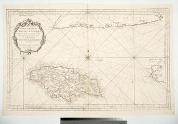
Cartouche: framed w. flowers and Royal Crest.. Prime meridian: Ferro, Paris, Teneriffe. Relief: pictorial. Graphic Scale: Leagues. Projection: Cylindrical. Watermark: Device lettering. Printing Process: Copper engraving. Other Features: Cartouche. Verso Text: MS note: 790.
093:790 M
Visual Materials
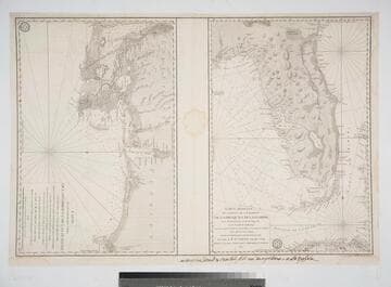
Two maps on one sheet. French script along lower border.. Prime meridian: Paris. Relief: hachures. Graphic Scale: Leagues. Projection: Cylindrical. Watermark: Crowned two-headed bird. Printing Process: Copper engraving. Verso Text: MS note: 99 M3.
105:099 M
Image not available
Visual Materials
Kashnor notes, "Shows the track of Cook and Clerke to the North-West Coast of Alaska, Australia and the South Seas." Kashnor dates as ca. 1781. Both Matthieu Albert and George Frederic Lotter listed as authors on map. Shows American arctic coast as vague line "according to the Japanese." Prime meridian: London. Relief: pictorial. Graphic Scale: No. Projection: Oval. Printing Process: Copper engraving. Verso Text: MS. notes: 1/113, 37, #93, No. 2..
093:037 M