Manuscripts
Map of Wilmington Street No. 60

You might also be interested in
Image not available
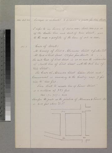
Wilmington Street - sketch maps
Manuscripts
Verso of p. 4, p. 6 of pinned document, "Wilmington Street Grade." first sketch shows First Street Widening, between Main & Alameda streets, showing courses, distances; second sketch shows Wilmington Street & Vine with area labeled Morse or Turner street, courses, distances [another sketch on verso may be a profile ?]. Title supplied by cataloger.
mssSolano SR_Box_33(17)

Map of a Lot of land
Manuscripts
P. 2 of pinned document, "Dr. Joseph Kurtz. Lot on West side of Main Street..." Showing courses, distances, parcel owners along Main at First St.; color outlining. Alt. title supplied by cataloger.
mssSolano SR_Box_29(20).01
Map of the Subdivision of the Pryor Tract of Land
Manuscripts
P. 6 of pinned document, "Vine Street Grade," showing Blocks 3-4 between First & Turner at Alameda street; showing numbered parcels, courses, distances, owners. Alt title supplied by cataloger.
mssSolano SR_Box_32(48).07
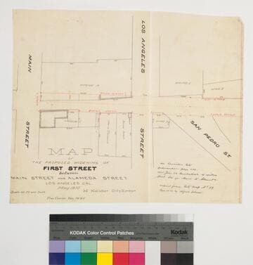
Map of the Proposed Widening of First Street between Main Street and Alameda Street
Manuscripts
P. 6 of stapled document, "House lot of Antonio Valla..." showing Main, Los Angeles & San Pedro streets, courses, distances, parcel owners; red highlighting. Copied by Alfred Solano.. Alt title supplied by cataloger.
mssSolano SR_Box_32(39).03
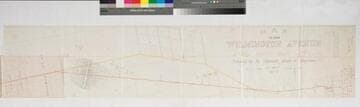
Map of the Wilmington Avenue County Road
Manuscripts
Original survey April 1876 by T.J. Ellis; Bound within document: "Field Notes of the Wilmington Avenue County Road," showing courses, distances; structures, parcel owners, section numbers. Copied by Alfred Solano. Alt. title supplied by cataloger.
mssSolano SR_Box_23(15).01
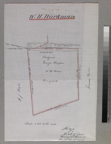
Map of a Tract of land surveyed.; at the request of George Crosson
Manuscripts
Orchard of George Crosson: vineyard, with courses, distances, acreage. Adjacent parcel owners: A. (Andrew) J. Boyle, Tomas Rubio. Copy by Alfred Solano. Alt title supplied by cataloger.
mssSolano SR_Box_33(24).01