Manuscripts
Part of boundary between ranchos la Cañada and San Rafael
You might also be interested in

Rancho la Cañada: S86, northern boundary : part of boundary between ranchos la Cañada and San Rafael
Manuscripts
Shows stations, parcel letters, numbers; with table of stations, courses, distances data.Title supplied by cataloger.
mssSolano SR_Box_20(11)
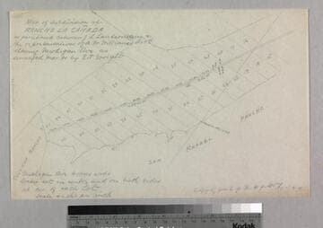
Map of subdivision of Rancho La Cañada
Manuscripts
Bordered by Ranchos Tujunga, San Rafael. ...as partitioned between J.L. Lanterman & reps of A.W. Williams, showing Michigan Avenue; parcel numbers, distances, markers, courses. Alt. title supplied by cataloger.
mssSolano SR_Box_20(11).08

Map Partition of Ro. La Cañada
Manuscripts
Bordered by Rancho San Pascual. Shows parcel numbers, distances, markers; notations. Followed by. Alt. title supplied by cataloger.
mssSolano SR_Box_20(11).06
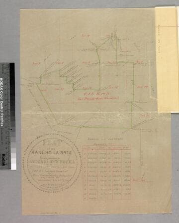
Plat of the Rancho La Brea finally confirmed to Antonio Jose Rocha
Manuscripts
Bordered by Ranchos San Antonio (or Rodeo de las Aguas), Las Cienegas, Los Felis and public land. Sixth page of document, "Rancho La Brea Patent," with color highlighting, talbe of boundary data; shows structures, courses, distances, section numbers, hachures, stations
mssSolano SR_Box_20(10).02
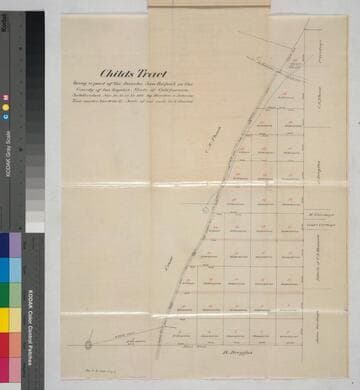
Childs Tract, being a part of the Rancho San Rafael.; Subdivided
Manuscripts
Pgs. 6 of document, "Child's Tract, being a part of the Rancho San Rafael..." showing parcel numbers in red with acreage, owners; courses, distances, waterway, post. Alt. title supplied by cataloger.
mssSolano SR_Box_27(14).06

Map of that part of the Rancho San Pedro allotted to Manuel Dominguez
Manuscripts
Bordered by Pacific Ocean, Rancho Los Cerritos, Sausal Redondo. Showing parcel owners: heirs of Maria Engracia Cota de Dominguez. Surface detail: hachures, water bodies, vegetation, subdivisions; color highlighting. Numerous tables with partitioned tract data, courses, distances, owners; table of allotments, Inner Bay, Salt Flat, Rattlesnake Island courses, distances. Signed by witnesses.
mssSolano SR_Map_0797