Visual Materials
A New and Accurate Map of North America, Drawn from the famous Mr. D'Anville with Improvements from the Best English Maps; and Engraved by R. W. Seale; Also the New Divisions according to the late Treaty of Peace, by Peter Bell Geor
You might also be interested in

America Septentrionalis : a Domino d'Anville in Galliis edita nunc in Anglia ; coloniis in interiorem Virginiam deductis nec non fluvii Ohio cursu aucta notisque geographicis et historicis illustrata et ad bellum praesentis temporis accomodata sumptibus / Homannianorum Heredum
Visual Materials
Kashnor notes, "This is copied from the engraving of the D'Anville map issued by Jefferys in 1755. The old boundaries of North and South Carolina, Florida, and Georgia, are the same, and the old statement regarding the right of these colonies to the land to the west of the Mississippi is engraved in Dutch [German]. The map was probably issued on account of the demand occasioned by the Revolution. The names of locations are, in many instances, in English, otherwise the old French names are given." MS note: 4. Prime meridian: London. Relief: pictorial. Graphic Scale: Miles, leagues. Projection: Pseudocylindrical. Printing Process: Copper engraving. Verso Text: Ms note: 314.
105:314 M
Image not available
North America From the French of M. d'Anville: Improved with the Back Settlements of Virginia and Course of the Ohio
Visual Materials
Kashnor notes, "A scarce map reduced from Jefferys' map." Kashnor dates as [1755]. This is a reprint of the Jefferys/ Anville map of 1755, see McCorkle 755.2 for other variations. This one is apparently not listed. "R. Cole sculp." Cartouche: flowered. MS note: 640 (on backing). Prime meridian: Ferro. Relief: pictorial. Graphic Scale: Miles. Projection: Pseudocylindrical. Printing Process: Copper engraving. Other Features: Cartouche.
105:640 S

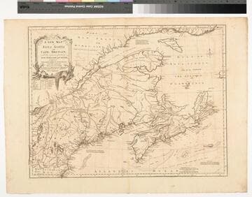
A New Map of Nova Scotia and Cape Britain. with the adjacent parts of New England and Canada, Composed from a great number of actual Surveys ; and other materials Regulated by many new Astronomical Observations of the Longitude as well as Latitude ; with an Explanation
Visual Materials
Kashnor notes, "The first issue of Jefferys' map. It was re-issued twenty years later by Sayer and Bennett." Kershaw states this is the second state of Jefferys map. Prime meridian: London, Ferro. Relief: pictorial. Graphic Scale: Miles, leagues. Projection: Pseudocylindrical. Watermark: I Ville Ary under IHS Crowned fleur-di-lis over LVC. Printing Process: Copper engraving. Other Features: Cartouche. References: Kershaw 739; McCorkle 755.20. Verso Text: MS note: 668.
105:668 M
Image not available
Accurate map of the United States of America, with Part of the Surrounding Provinces agreeable to the Treaty of Peace of 1783. by Jno. Cary
Visual Materials
Kashnor notes, "One of the best of the English Treaty Maps. Shows the Illinois Country and the country runs north to the Lake of the Woods; also locates Carver's wintering place in 1755." Articles I-III of the treaty (lower right). Prime meridian: London. Relief: pictorial. Projection: Pseudocylindrical. Printing Process: Copper engraving. Verso Text: MS notes: 397 35.
093:397 M
Image not available
Map of the West-Indies or the Islands of America in the North Sea; with ye adjacent Countries.; Spain, England, France, Holland &c. also ye Trade Winds, and ye several Tracts made by ye Galeons and Flota from place to place. According to the Newest and most Exact Observations by Herman Moll Geographer
Visual Materials
Kashnor notes, "The map also shows parts of Louisiana and South Carolina, and Central America. It is dedicated to William Paterson, the promoter of the Darien Colony." Kashnor dates as ca. 1720. View of Mexico City. Five submaps. See also 105:958 for another copy. View of Mexico City with building key; Submaps: St. Augustine; Vera Cruz; Havana; Darien; Cartagena.. Prime meridian: London. Relief: pictorial. Graphic Scale: Miles, leagues. Projection: Pseudocylindrical. Printing Process: Copper engraving. Other Features: VignettesSub-maps. Verso Text: MS notes: JO 328.
105:328 M
Image not available
New and Accurate Map of the World Drawn from the latest Observations
Visual Materials
Kashnor notes, "This is the same as Map 38 [105:038M] Mappe Monde, with the names and notes in English. Shows the North-West Coast and the South Seas immediately before the discoveries of Cook on his first voyage, but showing the coast of Alaska as found by the Russians. This was copied from Palariet's map." See 105:039M for rework of this map by Robert de Vaugondy in 1783. Note this map is slightly smaller than 105:038M and lacks border of original map. Climate zones shown Eastern Hemisphere. Antipodes on Western Hemisphere.. Prime meridian: Ferro. Relief: no. Graphic Scale: No. Projection: Dual Hemisphere. Printing Process: Copper engraving. Verso Text: MS notes: 42 H5.
105:042 M