Opening Hours
Daily: 10 A.M.–5 P.M.
Closed on Tuesdays
1151 Oxford Road
San Marino, CA 91108
Visual Materials
Daily: 10 A.M.–5 P.M.
Closed on Tuesdays
1151 Oxford Road
San Marino, CA 91108

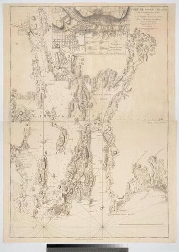
Visual Materials
Kashnor notes, "A very rare map, issued for use of the commanders of the French warships during the Revolution." One map in two sheets, with insert map of Newport. Submap of Newport, RI. Prime meridian: GM. Relief: hachures. Graphic Scale: Miles. Projection: Mercator. Watermark: Chained Maltese cross lettering. Printing Process: Copper engraving. Other Features: Sub-maps. Verso Text: Upper MS note:11. Lower sheet MS notes: 12 144.
105:144 M
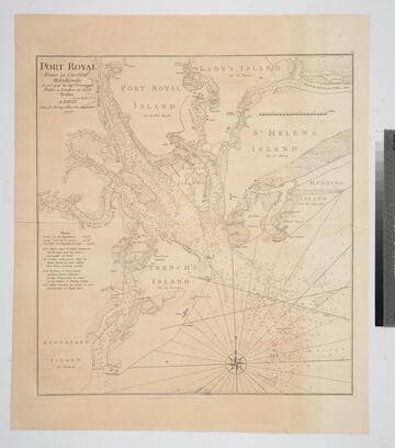
Visual Materials
Kashnor notes, "An exceedingly rare chart, taken from the original English chart, which is also exceedingly rare. This was issued for the use of the commanders of French Ships-of-War and Transports during the Revolution." Relief: no. Graphic Scale: Miles. Projection: Plane. Watermark: Chained Maltese cross lettering. Printing Process: Copper engraving. Verso Text: MS notes: 82 23.
105:082 M
Image not available
Visual Materials
Kashnor notes, "Indicates by different colours, English and French possessions, also disputed territories, and forts built by the French or taken from the English." Explanation of color use, etc. is given in both French and English. "On trouvera dans le troisiéme volume de la Nouvelle Introduction a la Géographie Moderne, que l'Auteur de l'Atlas Méthodique vient de mettre au jour, la description des pais, des peuples & des colonies de ce continent. Messrs." Prime meridian: London, Ferro. Relief: pictorial. Graphic Scale: Miles, Leagues. Projection: Pseudocylindrical. Printing Process: Copper engraving. Other Features: Cartouche. References: McCorkle 755.22. Verso Text: MS notes: (105) 659 Possessions Angloises Frances 1750 [all on backing].
105:659 M
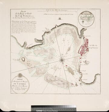
Visual Materials
Kashnor notes, "A rare map, giving a map of the town and all the old forts to the Cape." Kashnor dates as ca. 1760, submap shows 1780. Sub-map: Carte de St. Domingue 1780. Relief: hachures. Graphic Scale: Miles. Projection: Plane. Watermark: Chained Maltese cross lettering. Printing Process: Copper engraving. Other Features: Sub-maps. Verso Text: MS note: 422.
105:422 M
Image not available
Visual Materials
Kashnor notes, "Shows the course of the Missouri extending north of the Rockies, where the Spaniards forded the river to trade with the people for yellow iron, "du fer jaune." Also shows Carolina, Virginia, Maryland, and New Mexico." Kashnor dates as ca. 1720. This edition shows New Orleans. Submap of the Mississippi delta. MS note: 41 (upper right). Appeared in information from RLIN record. See 093:550M for an earlier version, 150047 for the same version, and 52352 for a reproduction. Submap: Carte Particuliere des Embouchures de la Riviere S. Louis et de la Mobile. Prime meridian: Ferro. Relief: pictorial. Graphic Scale: Leagues. Projection: Cylindrical. Printing Process: Copper engraving. Verso Text: MS note: 478.
105:478 M
Image not available
Visual Materials
Kashnor notes, "Includes the Bahamas and a portion of Cuba." MS note in French, lower right. Submap of Mississippi delta. Cartouche: draped. Submap: Carte des Embouchures du Fleuve St. Louis. Seal of Depot de la Marine. MS notes: lower right (in French). Prime meridian: Paris. Relief: no. Graphic Scale: Leagues. Projection: Cylindrical. Watermark: Shield lettering. Printing Process: Copper engraving. Other Features: CartoucheSub-maps. Verso Text: MS note: 480 M2.
105:480 M