Visual Materials
Oxnard-Santa Monica Highway, Calif. (Roosevelt Highway)

You might also be interested in
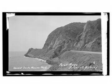
Oxnard-Santa Monica Blvd., Point Mugu, Roosevelt Highway
Visual Materials
Image an automobile at Point Mugu on Oxnard-Santa Monica Boulevard on the Roosevelt Highway (later Pacific Coast Highway), in Malibu, California.
photCL_555_06_2302
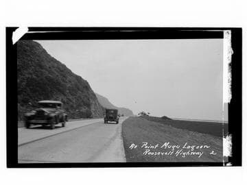
At Point Mugu Lagoon, Roosevelt Highway
Visual Materials
Image of automobiles at Point Mugu Lagoon, on Oxnard-Santa Monica Boulevard on the Roosevelt Highway (later Pacific Coast Highway), in Malibu, California.
photCL_555_06_2305
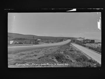
Highway 101 - Midway Santa Monica to Oxnard, Calif
Visual Materials
Image of the coastline looking south towards Point Dume from the Roosevelt Highway (later Pacific Coast Highway), and beach houses along Broad Beach near Trancas Canyon at Rancho Malibu, California, with the Malibu Trading Post, Cafe, cafe, Gilmore gas station, and a "Malibu Beaches" billboard visible.
photCL_555_06_2042
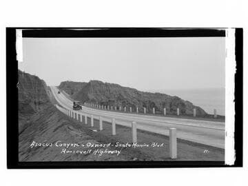
Asacus Canyon - Oxnard - Santa Monica Blvd., Roosevelt Highway
Visual Materials
Image of automobiles driving on the Roosevelt Highway (later Pacific Coast Highway) in the vicinity of Oxnard, California.
photCL_555_06_2296
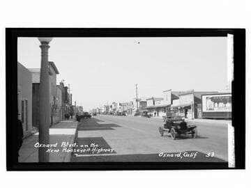
Oxnard Blvd. on the new Roosevelt Highway, Oxnard, Calif
Visual Materials
Image of automobiles lined along the business district at the 700 block of Oxnard Boulevard, on the Roosevelt Highway (later Pacific Coast Highway), with visible signs for New China chop suey, groceries and a pool hall labeled "Pool Hall, put Eastside inside, the perfect brew." A billboard for all-steel refrigerators from General Electric sold by Fred C. Snodgrass is visible at right.
photCL_555_06_2258

Boat and lighthouse homes on Oxnard-Santa Monica Blvd., Roosevelt Highway
Visual Materials
Image of Broad Beach near Trancas Canyon along the Roosevelt Highway (later Pacific Coast Highway) in Malibu, California, showing the mimetic architecture of a lighthouse-shaped beach house, known as Trancas Lighthouse, built for actress Pauline Frederick and the boat-shaped home built for businessman Freeman Ford.
photCL_555_06_2041