Visual Materials
Roosevelt Highway near Santa Monica, Cal

You might also be interested in

Roosevelt Highway, Santa Monica Bay
Visual Materials
Image of automobiles driving along the Roosevelt Highway (later Pacific Coast Highway) with the beach and the Santa Monica Bay at right near the Topanga Canyon area around Malibu and Pacific Palisades, California.
photCL_555_01_1215

Castle Rock and highway, Santa Monica
Visual Materials
Image of automobiles driving down Roosevelt Highway (later Pacific Coast Highway) past Castle Rock in Santa Monica, California
photCL_555_06_2153
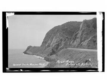
Oxnard-Santa Monica Blvd., Point Mugu, Roosevelt Highway
Visual Materials
Image an automobile at Point Mugu on Oxnard-Santa Monica Boulevard on the Roosevelt Highway (later Pacific Coast Highway), in Malibu, California.
photCL_555_06_2302
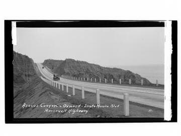
Asacus Canyon - Oxnard - Santa Monica Blvd., Roosevelt Highway
Visual Materials
Image of automobiles driving on the Roosevelt Highway (later Pacific Coast Highway) in the vicinity of Oxnard, California.
photCL_555_06_2296
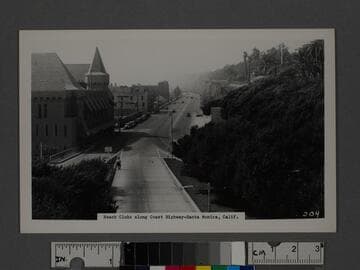
Beach Clubs along Coast Highway-Santa Monica, Calif
Visual Materials
Image of the Palisades Beach Road (part of the Roosevelt Highway and later Pacific Coast Highway), with the Deauville Club (with tower), Santa Monica Athletic Club, and Wavecrest Club, at left, and Palisades Park and bluffs at right.
photCL_555_01_1217
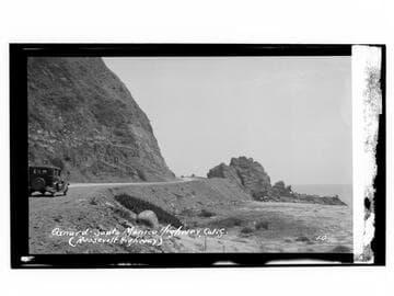
Oxnard-Santa Monica Highway, Calif. (Roosevelt Highway)
Visual Materials
Image of an automobile on the Roosevelt Highway (later the Pacific Coast Highway), next to rocks on the beach and Pacific Ocean, near Point Mugu and north of Malibu and south of the city of Oxnard, California.
photCL_555_06_2295