Opening Hours
Daily: 10 A.M.–5 P.M.
Closed on Tuesdays
1151 Oxford Road
San Marino, CA 91108
Daily: 10 A.M.–5 P.M.
Closed on Tuesdays
1151 Oxford Road
San Marino, CA 91108

Visual Materials
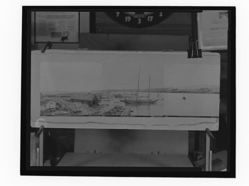
A photograph of a series of three photographs put together to form a panorama of San Pedro Harbor. The photographs are by I. W. Taber and have the following captions printed underneath: "3125. San Pedro Lumber Wharves and Wilmington Harbor" ; "3126. Wilmington Harbor from Rattlesnake Island." and "3127. Wilmington Harbor from Rattlesnake Island." Ships and small boats are seen in the harbor.
photCL_555_09_29
Visual Materials
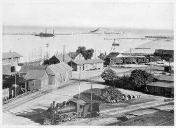
View of Dead Man's Island from the railroad yard.
photCL Pierce 05688
Image not available
Visual Materials
Consists of ten photographs of San Pedro, California. Subjects includes the coastline, the San Pedro breakwater, the cutter Collis, Point Fermin Elementary School, Cabillo Beach, Cabrillo Beach Boathouse (demolished in the 1970s), Los Angeles Harbor Light (Angels Gate Lighthouse), and Fish Harbor at Terminal Island. Companies shown on Wharf Street include Seacoast Packing Corporation and Van Camp Seafood Company.
photPF 2120-2129
Visual Materials
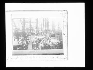
A copy of a photograph that appeared in Out West magazine, 1907, with the caption "A busy day at the San Pedro wharves." The view shows workers loading lumber on the wharf at San Pedro Harbor (present-day Los Angeles Harbor), with ships moored along the dock.
photCL_555_05_121
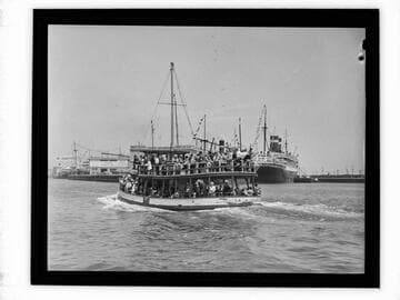
Visual Materials
A ferry boat carrying passengers back from Catalina Island entering the Los Angeles Harbor in San Pedro, California. A large ship and other boats are at dock in the background.
photCL_555_06_2549
Image not available
Rare Books
"Notes: Triangulation by Capt. E. O. C. Ord, U.S.A., W. E. Greenwell, A.W. Chase, Assist's and W. M. Johnson, Sub. Assist between 1854 & 1873." "Issued December, 1883. J. E. Hilgard, Supt." "Drawn by. R. Lindenkohl." Wilmington shows a few houses and Drum Barracks. San Pedro has only a few buildings, Rattlesnake Island [now Terminal Island] and Deadmans Island are prominent. Compare this map with 269464 of the same area in 1932. Stamp: Corrected to 1884 Aid to Navigation.. Prime meridian: GM. Relief: hachures. Graphic Scale: Miles, Km. Projection: Cylindrical. Printing Process: Lithography. Verso Text: MS note: 219203.
219203