Rare Books
Bankoku yakuzu Nishihankyū [cartographic material]
Image not available
Rare Books
Image not available
Daily: 10 A.M.–5 P.M.
Closed on Tuesdays
1151 Oxford Road
San Marino, CA 91108

Image not available
Manuscripts
World atlas containing 15 nautical charts, tables of declinations, etc. Of anonymous production, possibly by a Portuguese cartographer or based on a Portuguese prototype; the 2 final charts by a different person. Bound, circa 1805, in French straight grain red morocco, gilt; rebacked, original spine laid down.
mssHM 29
Image not available
Manuscripts
World atlas containing 10 nautical charts, table of declinations, etc.: 1. f. 1v: Circular calendar 2. f. 2v: Table of declinations 3. f. 3: Armillary sphere 4. ff. 3v-4: Zodiac with small Atlantic hemisphere in center with a central cord to be used as a pointer 5. ff. 4v-5: Pacific Ocean with portions of North America, South America, Asia, and East Indies 6. ff. 5v-6: Atlantic Ocean with portions of North America, South America, Europe, and Africa 7. ff. 6v-7: Indian Ocean, Africa, southern Asia, and portion of East Indies 8. ff. 7v-8: British Isles, France, and northern Spain 9. ff. 8v-9: Iberian peninsula and northwest Africa 10. ff. 9v-10: Western Mediterranean and Italy 11. ff. 10v-11: Eastern Mediterranean, Italy, and Aegean Sea 12. ff. 11v-12: Black Sea 13. ff. 12v-13: Aegean Sea 14. ff. 13v-14: Oval map of the world (showing one route: around the world via the Moluccas) 15. f. 14v: Ruling for calendar.
mssHM 27
Image not available
Manuscripts
World chart, from the eastern coasts to India.
mssHM 427
Manuscripts
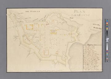
A manuscript copy, probably made around 1758. Shows detailed layout of the fortifications around Louisburg.
mssHM 15411