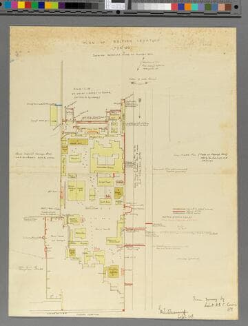
Defence of foreign legations, Peking, China, June 20th to Aug. 14th, 1900 [cartographic material]
Image not available
Description
One of the first official map of Beijing's Legation Quarter (Dong Jiaomin Xiang / 東江米巷) to illustrate the events of the Boxer Rebellion (1899-1901) and the siege of the Foreign Legations. The map was prepared by the American military engineer Harley Bascom "Fergie" Ferguson, who was sent to Beijing in 1900 as part of the China Relief Expedition. Produced in cyanotype (blueprint) in very small quantities, this map forms the basis of all subsequent maps of the Legation Quarter's defense.
Purchased by the Library Collectors' Council from Geographicus Rare Antique Maps, January 19, 2019. Acquired with a related map, Henry Edward Colvin Cowie's Plan of the British Legation (call number 647411) which has the signature of "Capt. Poole" (Francis Garden Poole, 1870-1950). Poole was in charge of the civilian volunteer combat force during the Siege. Both maps appear to share the same Poole provenance.
Shows layout of the British Legation in the Siege of 1900 during the Boxer Rebellion. Depicts barricades and defensive lines as well as the enemy attack works. Covers the Legation quarter in Beijing concentrating on the area of the British Legation, with the boundaries of the Russian Legation to the South, the Japanese Legation to the West and the Han-Lin Great Library to the North. The Su Wang Fu residence is depicted as well.