Rare Books
Duncan's itinerary of Scotland ; with the principal roads to London, copious observations on each road, and an appendix, containing some account of the canals, lakes, mountains, harbours, and romantic scenery
Image not available
You might also be interested in
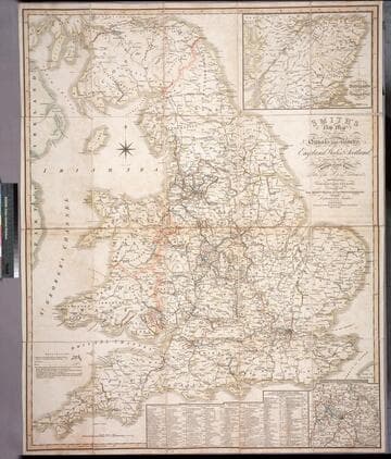
Smith's new map of the navigable canals and ri vers, of England, Wales & Scotland : distinctly shewing the length of each line, and the dates of the Acts of Parliament which have passed for executing the same ; containing also the direct roads to the principal places, with their distance from London
Rare Books
Alternate title from cover. A detailed map of the extensive network of canals and rivers crossing the UK in early 1800's. Submaps: Canals in the Environs of Birmingham; Continuation of Scotland including the Caledonian Canal. Table of principal canals with lengths. Prime meridian: GM. Relief: no. Graphic Scale: Miles. Projection: Polyconic. Printing Process: Engraving.
446560