Opening Hours
Daily: 10 A.M.–5 P.M.
Closed on Tuesdays
1151 Oxford Road
San Marino, CA 91108
Daily: 10 A.M.–5 P.M.
Closed on Tuesdays
1151 Oxford Road
San Marino, CA 91108

Image not available
Visual Materials
Kashnor dates as ca. 1759. See 105:683 for duplicate copy. Submaps: The Seven Islands; A Continuation of the River St. Lawrence from Quebec to Lake Ontario; The Traverse or Passage from Cape Torment into the South Channel of Orleans Island. Text transfer from printed sheet both front and verso. MS note: 338 (on backing). Relief: no. Graphic Scale: Leagues. Projection: Plane. Printing Process: Copper engraving. Verso Text: MS note: 338 (on backing) Text transfer.
093:338 S
Image not available
Visual Materials
Kashnor notes, " with inset plan of the River St. Lawrence from Green Island to Quebec on a large scale, by Rt. Blachford, charts of Gaspee Bay, Quebec Basin, Seven Sisters Bay &c. and views of land falls." Contains detailed sailing directions suggested by Capt. Kirby. Cartouche with hunter, birds, ship. Submaps: Continuation of the River from Quebec to Montreal; Quebec Bason; A Particular Plan of the River St. Laurence, From Green Island to Quebec, on a large Scale, by Rt. Blachford. 1811; Gaspee Bay; Havre St. Nicholas; Bay of Seven Islands; Parokeet Islands and Mingan Island; Mingan Town. Vignettes: View of Belle Chase Windmill; Cape Goose; Three Mountains; Cape l'Original; Cape Gaspee; view of land between Island Bonaventura and Cape Roziers; view of the land between Cape de Monts Pelles and Point de Manicouagan; Egg Island.. Relief: hachures. Graphic Scale: Leagues. Projection: Plane. Printing Process: Copper engraving. Other Features: CartoucheSub-mapsVignettes. Verso Text: MS note: 353.
093:353 M
Image not available
Visual Materials
Largely a copy of the Cook and Lane map of 1766-69. See 105:553M for an English copy. Submaps: Havre de Labrador; Red Bay ou Baye Rouge; Baye de Chateaux ou D'York; Vieux Ferolle.. "Tiré des Plans Anglais de J. Cook et M. Lane." "No. 150 [upper right]. Prix. Un Franc et demi. Seal of Dept General de la Marine." Relief: hachures. Projection: Plane. Printing Process: Copper engraving. Other Features: Sub-maps. Verso Text: MS note: 564 Two labels torn from verso..
105:564 M
Image not available
Visual Materials
This is Sanson's version of famous de l'Isle map with South America curving west. See 093:610 or RB 295821. Kashnor dates as ca. 1680, but de l'Isle's map preceded this one. Kashnor notes, "Shows the Argentine provinces as "Provinces de Rio de la Plata." Cartouche: Figures & scrolling. MS note: No. 1 (upper left). Prime meridian: Ferro. Relief: pictorial. Graphic Scale: Leagues. Projection: Pseudocylindrical. Printing Process: Copper engraving. Verso Text: MS notes: 631.
093:631 M
Image not available
Visual Materials
Kashnor identifies Paris as production place. Submap of Boston Harbor. Submap: Plan du Havre de Baston.. Prime meridian: Paris, London, Lizard, Teneriffe, Fer. Relief: pictorial & hachures. Graphic Scale: Leagues. Projection: Mercator. Watermark: Lettering. Printing Process: Copper engraving. Other Features: Sub-maps. Verso Text: MS note: 454.
093:454 M
Visual Materials
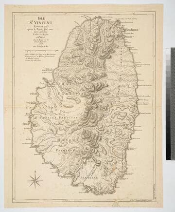
Kashnor notes, "A good map by le Rouge (after Jefferys)." Prime meridian: London. Relief: hachures. Graphic Scale: Miles. Projection: Cylindrical. Watermark: Chained maltese cross lettering. Printing Process: Copper engraving. Verso Text: MS note: 832.
093:832 M