Rare Books
MacLean & Lawrences sectional map of Kansas Territory : compiled from the U.S. survey's / by C.P. Wiggin
You might also be interested in
Image not available
Topographical map of Wisconsin Territory : compiled from the public surveys, on file in the Surveyor General's office ; / by Samuel Morrison, Elisha Dwelle ; Joshua Hathaway
Rare Books
Territory south of the Wisconsin River. "I certify that this Map is faithfully reduced from the original plats of the Public Surveys on file in this office. Robt. T. Lyle, Surveyor General, Cincinnati April 1st, 1837." Prime meridian: GM. Relief: hachures. Graphic Scale: Miles. Projection: Cylindrical. Printing Process: Lithography.
377199
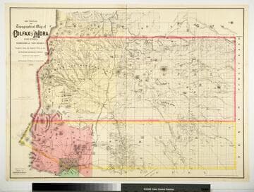
Sectional and Topographical Map of Colfax and Mora Counties Territory of New Mexico
Rare Books
Numerous changes have been made since the earlier map, 128069. "Compiled from the Original Plats in the Surveyor Generals Office Santa Fe, New Mexico. J. S. Taylor U. S. Deputy Surveyor, 1881." "Entered according to Act of Congress in the year 1882 by G.W. & C.B. Colton & Co. in the Office of the Librarian of Congress, at Washington." Prime meridian: GM. Relief: hachures. Graphic Scale: Miles. Projection: Cylindrical. Printing Process: Lithography. Verso Text: HL sticker: 128313.
128313
Image not available
Froiseth's new sectional & mineral map of Utah : compiled from the latest U.S. Government surveys and other authentic sources, exhibiting the sections, fractional sections, counties, cities, towns settlements, mines, railroads, and other internal improvements
Rare Books
An added section shows mining claims in Nevada in manuscript format. Alt title taken from cover. Submaps: City of Corrine; City of St. George; Provo City; Salt Lake City; Ogden City; Logan City; City of Stockton. Prime meridian: GM. Relief: hachures. Graphic Scale: Miles. Projection: Cylindrical. Printing Process: Lithography.
252059
Image not available
North-West Territory : Map shewing Dominion Land Surveys between west boundary of Manitoba and third principal meridian / From a map compiled by E. Deville, Inspector in charge of current surveys
Rare Books
"Published by the Authority of The Right Hon. Sir John A. Macdonald, K.C.B. Minster of the Interior." "Lindsay Russell, Surveyor General." MS note: 317929. Prime meridian: GM. Relief: hachures. Graphic Scale: Miles. Projection: Cylindrical. Printing Process: Lithography.
317929
Image not available
New mining map of Utah : showing the location of the mining districts over an extent of territory 150 miles from North to South : compiled from U.S. government survey's [sic] and other authentic sources / by B.A.M. Froiseth ; aided by H.R. Durkee
Rare Books
Alt. title from cover. Many advertisements in the surround. Submaps: Ophir; City of Alta; Eureka City; City of Stockton. Prime meridian: GM. Relief: hachures. Graphic Scale: Miles. Projection: Cylindrical. Printing Process: Lithography.
35340
Image not available
Official map of San Bernardino County, California : compiled from latest official maps of U.S. surveys, railroad and irrigation surveys, county records, and other reliable sources / & drawn by T.D. Beasley
Rare Books
See RB 477777 for a map of the Southwest portion of San Bernardino County. Submaps shows claims in mining distrcts. "We the members of the Board of Supervisors of San Bernardino County California, hereby adopt this map as the Official Map of said County. San Bernardino, May 18th, 1892." Submaps: Mining districts of Calico, Holcomb Valley, Bear Valley, Clark, Ord Mountain, Trojan with claims. Prime meridian: Gm. Relief: hachures. Graphic Scale: Miles. Projection: Cylindrical. Printing Process: Lithography.
477787