Rare Books
Map showing the subdivision of lands belonging to the Fairview Land & Water Company in San Diego County California / Surveyed by B. Bassell C.E
You might also be interested in

Tamalpais Land and Water Company map no. 2 : showing Eastland and Millwood, Marin County, California / surveyed by M.M. O'Shaunessy, C.E. 1889, with additions and modifications by L.H. Shortt, C.E. 1891
Visual Materials
Old shelf number: eph J4-9(2). An expansion of the year earlier map ephMPCALIFT0066. Prime meridian: GM. Relief: no. Graphic Scale: Feet. Projection: Plane. Printing Process: Lithography. Verso Text: MS note: Eph J4-9(2).
ephMPCALIFT0067
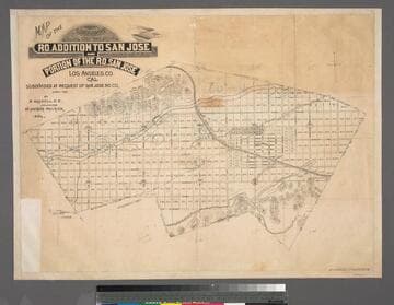
Map of the subdivision of the Ro. addition to San Jose and portion of the Ro. San Jose Los Angeles Co., Cal.; subdivided at the request of San Jose Ro. Co. April 1887 / by B. Bassell, C.E.; field-work by Arthur Philbrick, Sur
Rare Books
Map of the area of San Dimas. MS note: 384612 numerous lot notes. Edge bound. Prime meridian: GM. Relief: hachures. Graphic Scale: Chains. Projection: Plane. Printing Process: Lithography.
384612
Image not available
Map showing subdivision of land belonging to the Semi-Tropic Land and Water Company, in township 1 North, range 5 West S. B. M. including Western Portion of Muscupiabe Grant San Bernardino County, California
Rare Books
A subdivision placed within the apparent flood plain of Lytle Creek. A gift of the Friends of the Huntington Library. Prime meridian: GM. Relief: no. Graphic Scale: Chains. Projection: Plane. Printing Process: Lithography. Verso Text: MS notes: 252634 Muscupiade Rancho ORS/ 5.00 4.00.
252634
Image not available
Map of Gander River and Lake Surveyed by Alex. Murray, Esq. F.G.S. 1874
Visual Materials
Site of present day Gander, Newfoundland. Description of various land features. A map to sell real estate. MS note: 261 (on backing). Prime meridian: GM. Relief: hachures. Graphic Scale: Miles. Projection: Plane. Printing Process: Lithography. Verso Text: MS note: 261 (on backing).
093:261 M
Image not available
Map of Stanford Heights, Stanford Heights Co., surveyed June 1891, by M.M. O'Shaughnessy C.E
Visual Materials
Old shelf number: eph J4-1 (5a). Prime meridian: GM. Relief: no. Graphic Scale: Feet. Projection: Plane. Printing Process: Lithography. Verso Text: MS note: Eph J4-1 (5a) Map of Stanford Heights in relation to city, sales information.
ephMPCALIFT0031
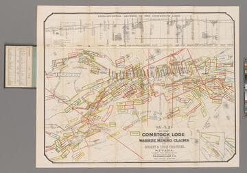
Map of the Comstock Lode and the Washoe Mining Claims in Storey & Lyon Counties, Nevada / Compiled from Official Surveys and other reliable data by T. D. Parkinson, C.E
Rare Books
Longitudinal Section of the Comstock Lode. Prime meridian: GM. Relief: hachures. Graphic Scale: Feet. Projection: Plane. Printing Process: Lithography. Verso Text: MS note: 240738.
240738