Visual Materials
An accurate map of the islands of New Found Land, Cape Breton, &c.; with the adjacent province of Nova Scotia
You might also be interested in
Image not available
Map of New England and Nova Scotia; with part of New York, Canada, and New Britain & the adjacent Islands of New Found Land Cape Breton &c. by Tho. Kitchin Geogr
Visual Materials
Kashnor notes, "A scarce map issued at the time of the Old French War." RLIN record gives date and published in information. Cartouche: harbor/forest scene. MS note: 280 (on backing). Prime meridian: London. Relief: pictorial. Graphic Scale: Miles. Projection: Cylindrical. Watermark: Seal circular device. Printing Process: Copper engraving. Other Features: Cartouche. References: Kershaw 708; McCorkle 758.7. Verso Text: MS note: 280 (on backing).
093:280 S

Accurate Map of Cuba, and the Adjacent Islands; by G. Rollos, Geogr
Visual Materials
Kashnor dates as ca. 1760. MS note: 748 (on backing). Prime meridian: London. Relief: pictorial. Projection: Pseudocylindrical. Printing Process: Copper engraving. Verso Text: MS note: 748 (on backing).
093:748 S
Image not available
A Map of New England and Nova Scotia; with parts of New York, Canada, and New Britain & the adjacent islands of New Found Land, Cape Breton, &c
Rare Books
Cartouche: Trees and harbor MS note: 923. "By Tho. Kitchin Geogr." Prime meridian: London. Relief: pictorial. Graphic Scale: Miles. Projection: Conic. Watermark: Two seals. Printing Process: Copper engraving. Other Features: Cartouche. Verso Text: MS note: 150237.
150237
Image not available
Accurate Map of Louisiana, and the Territory in Dispute between the English & French
Visual Materials
Kashnor notes, "Includes parts of Virginia, North and South Carolina, Georgia and Florida." Kashnor dates as ca. 1755. RLIN record suggests 1761. RLIN record covers a photocopy but is included to add data of appeared in information. MS note: 421 (on backing). Prime meridian: London. Relief: pictorial. Graphic Scale: Miles. Projection: Pseudocylindrical. Printing Process: Copper engraving. Verso Text: MS note: 421 (on backing).
093:421 S
Image not available
Plan of Cape Breton, &c Fort Louisbourgh, &c
Visual Materials
Kashnor notes, "A very rare map, issued probably in Boston soon after the taking of Louisbourg by Pepperell." Kershaw suggests Thomas Johnston as map author as does Wheat & Brun. (Wheat and Brun refer to Museum Book Store catalog, this map.) Lower map detail of Louisbourgh defenses and British forces. MS note: 291 (on backing).. Prime meridian: London. Relief: no. Projection: Cylindrical. Watermark: I-ro Pa-- seated figure, sun with face and rays. Printing Process: Copper engraving. Other Features: Sub-maps. References: Kershaw 893; Wheat & Brun 71.. Verso Text: MS note: 291 (on backing)..
093:291 S

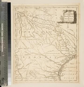
A new and accurate map of the province of Georgia in North America
Visual Materials
Kashnor notes, "Shows the old trading paths and the Hunting Grounds of the Cherokees." Kashnor dates c.1776. RLIN record notes date as [1779?] and place of publication as [London?] and as appearing in The Universal Magazine of 1779. See 093:391 and 105:103 for additional copies. MS note: 94 (on backing). Prime meridian: [Ferro]. Relief: pictorial. Projection: Cylindrical. Watermark: Crowned circular seal. Printing Process: Copper engraving. Other Features: Cartouche. Verso Text: MS note: 32 94(on backing).
093:094 S