Opening Hours
Daily: 10 A.M.–5 P.M.
Closed on Tuesdays
1151 Oxford Road
San Marino, CA 91108
Rare Books
Daily: 10 A.M.–5 P.M.
Closed on Tuesdays
1151 Oxford Road
San Marino, CA 91108

Image not available
Visual Materials
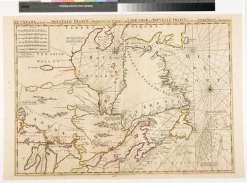
Kashnor dates as ca. 1720. This is a French copy of Moll's 1720 map. RLIN record suggests publication may have been as late as 1756. "Pl 20." (upper right). "2[?]" (lower right). MS note: 576 (on backing). Prime meridian: Ferro. Relief: pictorial. Graphic Scale: Leagues. Projection: Cylindrical. Printing Process: Copper engraving.
105:576 S
Visual Materials
Kashnor notes, " This locates the fort below Port Nelson, 'occupé par le compagnie qui s'est formée en Canada pour la Baye de Hudson' ; also the forts of St. Duluth, St. Germkain, &ce., intended to protect the French settlements and to prevent the trading passing through to Hudson's Bay." Kashnor dates as ca. 1696. RLIN record suggests 1692. Prime meridian: Ferro. Relief: pictorial. Graphic Scale: Miles, leagues. Projection: Cylindrical. Watermark: linked PL. Printing Process: Copper engraving. Verso Text: MS note: 429.
105:429 M
Image not available
Rare Books
A colorful map showing the colonies limited east of the Appalachians. Pittsburgh is shown as Fort du Quesne in French territory. Appeared in Tobias Conrad Lotter's Atlas geographique, 1778. Cartouche: crowned with cost of arms. MS note: 111315. Prime meridian: [Ferro]. Relief: pictorial. Graphic Scale: Leagues. Projection: Pseudocylindrical. Watermark: Device with partial cross. Printing Process: Copper engraving. Other Features: Cartouche. Verso Text: MS note: Englisches Amerika.
111315
Image not available
Visual Materials
This is a copy of Visscher's map, see 093:632. See also 093:633, 093:635 for other versions. Kashnor dates as ca. 1720. RLIN record suggests 1718. Cartouche: Figures. Prime meridian: Ferro. Relief: pictorial. Graphic Scale: Leagues. Projection: Pseudocylindrical. Watermark: M W. Printing Process: Copper engraving. Verso Text: MS note: 924.
105:924 M
Visual Materials
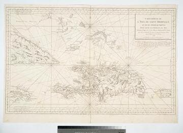
Prime meridian: Paris, London, Lizard, Tenerife, Ferro. Relief: pictorial. Graphic Scale: Leagues. Projection: Cylindrical. Watermark: Lettering double headed eagle. Printing Process: Copper engraving. Verso Text: MS note: 416.
105:416 M
Image not available
Visual Materials
Kashnor notes, "Indicates the coast of California to the Juan de Fuca Strait." Kashnor locates publication as Paris, author as Jean Palariest. MS note: 12 Jean Palariat. Prime meridian: Ferro. Relief: pictorial. Graphic Scale: Miles (naut), leagues. Projection: Pseudocylindrical. Watermark: Crowned fluer-di-lis IV. Printing Process: Copper engraving. Other Features: Cartouche. Verso Text: MS notes: 168 12.
093:168 M