Opening Hours
Daily: 10 A.M.–5 P.M.
Closed on Tuesdays
1151 Oxford Road
San Marino, CA 91108
Manuscripts

Daily: 10 A.M.–5 P.M.
Closed on Tuesdays
1151 Oxford Road
San Marino, CA 91108

![Plan de la riviere de Canada [cartographic material]](/_next/image?url=https%3A%2F%2Frail.huntington.org%2FIIIF3%2FImage%2F22APN4MOZ67W%2Ffull%2F%5E360%2C%2F0%2Fdefault.jpg&w=750&q=75)
Manuscripts
Manuscript chart of the Gulf and River of St. Lawrence, from Gaspé Bay to the Island of Orleans (Île d'Orléans). Shows the Island of St. John (Île de St. Jean) and the northern part of Acadia. North is to the bottom of the map. Phrase "NB the Red dente that part taken from another map" appears below title. Drawn by Charles Rivez, appears to be a copy of HM 15433, with additions from another map.
mssHM 15436
![Carte de l'Isle de Terre Nueve, Isle Royalle et Golphe et Riviere St. Laurent [cartographic material]](/_next/image?url=https%3A%2F%2Frail.huntington.org%2FIIIF3%2FImage%2F22APN4MOIQX5%2Ffull%2F%5E360%2C%2F0%2Fdefault.jpg&w=750&q=75)
Manuscripts
Manuscript map drawn by Charles Rivez, apparently a copy of an earlier map. Shows the St. Lawrence from Quebec to the Isle of Anticosti, locating Québec, the islands, rivers, capes and mountains. The inset map shows the the Gulf of St. Lawrence from the Strait of Belle Isle to Nova Scotia, with Newfoundland, Cape Breton, Isle of St. John and the coast to Gaspee Bay. Soundings are noted for the Gulf. Another copy of this map, also by Charles Rivez shows more detailed soundings, for both St. Lawrence River and the Gulf, has the shoals and and banks colored in blue and sailing directions in English (see mssHM 15430).
mssHM 15429
![Newfoundland in 1842 [cartographic material] / Surveyed and drawn by Lieut. Col. Sir Richard Bonnycastle](/_next/image?url=https%3A%2F%2Frail.huntington.org%2FIIIF3%2FImage%2F22APN4MO7X1K%2Ffull%2F%5E360%2C%2F0%2Fdefault.jpg&w=750&q=75)
Manuscripts
Manuscript map showing settled areas, population figures, industries and geological compositions. Elevations indicated by dashed lines. Coastal areas and water features are shaded in blue wash. The locations of expeditions by McCormack in 1827 and 1832 are shown.
mssHM 15402
![Carte de l'Isle de Terre Nueve, Isle Royalle et Golphe et Riviere St. Laurent [cartographic material]](/_next/image?url=https%3A%2F%2Frail.huntington.org%2FIIIF3%2FImage%2F22APN4MOIRQD%2Ffull%2F%5E360%2C%2F0%2Fdefault.jpg&w=750&q=75)
Manuscripts
Manuscript map drawn by Charles Rivez, apparently a copy of an earlier map. Shows the St. Lawrence from Quebec to the Isle of Anticosti, locating Québec, the islands, rivers, capes and mountains. The inset map shows the the Gulf of St. Lawrence from the Strait of Belle Isle to Nova Scotia, with Newfoundland, Cape Breton, Isle of St. John and the coast to Gaspee Bay. Detailed soundings are given for both the river and gulf maps. Shoals and banks are colored in blue. An observation of sailing directions is in English and in a different hand than Rivez. Another copy of this map, also by Charles Rivez shows soundings for the gulf and none for the river. (see mssHM 15429).
mssHM 15430
Visual Materials
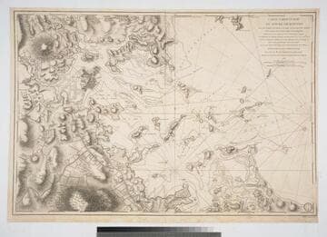
Kashnor notes, "Issued for the use of the French ships-of-war during the Revolution." Author from RLIN record. Note similarity of sailing instructions to those of earlier map 105:065M. Seal of Dept. of Marine lower right.. Prime meridian: Paris. Relief: hachures. Graphic Scale: Millies, Statues, Marine. Projection: Plane. Watermark: Eagle. Printing Process: Copper engraving. Verso Text: MS note: 64.
105:064 M
![Carte du Lac St. Sacrement avec une partie du Lac Champlain depuis le Fort Frederic jusqu'au Sauts de la Riviere d'Orange ou de Hudson & forts batis nouvellement par les Anglois [cartographic material]](/_next/image?url=https%3A%2F%2Frail.huntington.org%2FIIIF3%2FImage%2F22APN4MODODO%2Ffull%2F%5E360%2C%2F0%2Fdefault.jpg&w=750&q=75)
Manuscripts
Detailed manuscript map depicting the area of Albany to Fort Saint Frederic or Crown Point during the Crown Point Expedition, 1755 in the French and Indian War. The map was drawn up by or for General Baron Jean-Armand Dieskau and was in his possession when he was captured by General William Johnson. Lac St. Sacrement was later renamed Lake George.
mssHM 15405