Rare Books
Map the central part of the City of Los Angeles California
You might also be interested in
Image not available
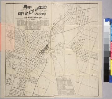
Map of Los Angeles City. Published by C. Grosmann
Rare Books
Hand coloring shows various street materials used in paving 105.99 miles of city streets. Later MS additions show horse car lines and railroads existing up to January 1895. Additions by L. P.; "Compliments of Edward D. Silent & Co. 212 West Second St. Tel M 695." Relief: no. Projection: Plane. Printing Process: Letterpress. Verso Text: MS note: 218334.
218334

Dana Burks' Map of Los Angeles Accompanying the Los Angeles City Directory 1901
Rare Books
Hand coloring shows various street materials used in paving 105.99 miles of city streets. Later MS additions show horse car lines and railroads existing up to January 1895. "Copyright 1901 by Los Angeles City Directory Co." "Note: Half mile circles are from Plaza. Business center is at Third and Spring Streets." Additions by L. P.; Relief: no. Projection: Plane. Printing Process: Lithography.
150241

Map of the Proposed Sewer System for the City of Los Angeles
Rare Books
Hand coloring shows various street materials used in paving 105.99 miles of city streets. Later MS additions show horse car lines and railroads existing up to January 1895. Additions by L. P. "Designed 1887 by: Fred Eaton, City Surveyor, Revised and Endorsed by: Rudolph Hering Consulting Engineer." ; MS note: 384443. Relief: no. Graphic Scale: Scale 1" to 1200 ft.. Projection: Plane. Printing Process: Lithography. Verso Text: Explanatory remarks by Fred Eaton, suggesting a cost of $1,000,000 to construct the proposed system. Report of consulting engineer Rudolph Hering dated September 6, 1887 supporting Eaton's work, and suggesting spreading fields as a suitable method. .
384443
Image not available
Map of the City of Los Angeles to Accompany the Annual Report of J. H. Dockweiler City Engineer Dec. 1891
Rare Books
Hand coloring shows various street materials used in paving 105.99 miles of city streets. Later MS additions show horse car lines and railroads existing up to January 1895. Additions by L. P. Reeve, C.E. "Showing the varieties of street pavements laid on Dec. 1st. 1891." Relief: no. Projection: Plane. Printing Process: Letterpress. Verso Text: MS notes: 1660 202454.
202454
Map of the central part of the City of Los Angeles, California
Rare Books
This map shows (18) electric light masts in place across the city, some 150 ft tall, some 60 ft tall. Reference tables listing buildings, etc.. Prime meridian: GM. Relief: no. Graphic Scale: Feet. Projection: Plane. Printing Process: Lithography.
213826
Image not available
Map of the City of Los Angeles
Rare Books
Hand coloring shows various street materials used in paving 105.99 miles of city streets. Later MS additions show horse car lines and railroads existing up to January 1895. Additions by L. P.; "Street cars run on all streets marked with red lines. Streets marked 1,2,3,4 or 5 in red denote the street car lines which run on these streets. 1. Los Angeles Railway; 2. Pacific Electric Railway; 3. Los Angeles Pacific Railway; 4. Traction Line; 5. Los Angeles - Redondo Electric Line. [Bimini Baths and L. A. Country Club also marked in red.]" "Copyright 1904 by Newman & Wilson." Relief: no. Projection: Plane. Printing Process: Two color letterpress. Verso Text: MS note: 202453..
202453