Opening Hours
Daily: 10 A.M.–5 P.M.
Closed on Tuesdays
1151 Oxford Road
San Marino, CA 91108
Visual Materials
Daily: 10 A.M.–5 P.M.
Closed on Tuesdays
1151 Oxford Road
San Marino, CA 91108

Visual Materials
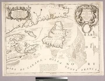
Kashnor notes, "Showing the mouth of the St. Laurence, with Newfoundland, Cape Breton Island, and parts of Nova Scotia and the Coast of Canada." Kashnor dates ca. 1690. Coronelli was active in Venice. Fish entwined cartouche.. Relief: no. Graphic Scale: Miles, leagues. Projection: Cylindrical. Watermark: Small circled fleur-di-lis.. Printing Process: Copper engraving. Other Features: Cartouche. References: Kershaw (Canada) 162. Verso Text: MS note: 251.
093:251 M
Image not available
Visual Materials
This is Buache's copy of Visscher's map, see 093:632. See also 093:633, 093:634 for other versions. Cartouche: Figures.. Prime meridian: Ferro. Relief: pictorial. Graphic Scale: Leagues. Projection: Pseudocylindrical. Watermark: Circled device lettering. Printing Process: Copper engraving. Other Features: Cartouche. Verso Text: MS note: 633 3J.
093:635 M
Image not available
Visual Materials
Kashnor notes, "Though bearing a French title and imprint, with all names of places in French, it is obviously an English map issued to show the French claims and the English boundaries as well as French encroachments." McCorkle confirms map as by Kitchin, first edition. See also 105:622M for another copy. Cartouche: flowered.. Prime meridian: London, Ferro. Relief: pictorial. Graphic Scale: Miles, leagues. Projection: Pseudocylindrical. Watermark: Crowned fleur-di-lis IV. Printing Process: Copper engraving. Other Features: Cartouche. References: McCorkle 755.22. Verso Text: Ms note: 515 partially erased, North America English --- 5..
093:515 M
Visual Materials
Kashnor notes, "A rare map showing parts of Florida and "Florida Gallica", now Georgia. It also shows the coast of present-day Texas, with the old Spanish locations." Alt. title in upper margin. Prime meridian: Ferro. Relief: pictorial. Graphic Scale: Miles. Projection: Mercator. Printing Process: Copper engraving. Verso Text: MS note: 798.
105:798 M
Image not available
Visual Materials
Kashnor notes, "A scarce map, showing the back settlements and the Cherokee country." Kashnor dates as ca. 1745. Small cartouche.. Prime meridian: London. Relief: pictorial. Graphic Scale: Miles. Projection: Pseudocylindrical. Watermark: Fleur-di-lis, IW. Printing Process: Copper engraving. Other Features: Cartouche. Verso Text: MS note: 369.
093:369 M
Image not available
Visual Materials
Kashnor notes, "A very scarce map, showing California as an island, locating Pto. de Francisco Draco, Monterey, and San Diego." McLaughlin identifies as State 1 of an Italian version of the 1669 revision of Sanson's original 1650 map. Map taped to frame, stained from glueing center section, needs conservation. Information on display frame is incorrect. Prime meridian: Ferro. Relief: pictorial. Projection: Pseudocylindrical. Watermark: Circled fleur-di-lis. Printing Process: Copper engraving. Other Features: Cartouche. References: McLaughlin 65; Wheat 59; Tooley 42; Leighly 53; Portinaro (Plate XCVI, State 3),. Verso Text: MS notes: America Settenrionale (three times).
105:211 M