Opening Hours
Daily: 10 A.M.–5 P.M.
Closed on Tuesdays
1151 Oxford Road
San Marino, CA 91108
Visual Materials
Daily: 10 A.M.–5 P.M.
Closed on Tuesdays
1151 Oxford Road
San Marino, CA 91108

Image not available
Visual Materials
Kashnor notes, "Shows the boundary of Oregon reaching north in a semicircle from Juan de Fuca Straits to include the northern part of the Columbia River, and as part of the United States." "Gravée sous la direction de l'Auteur. Atlas Universal Pl. 33" Prime meridian: Paris. Relief: hachures. Graphic Scale: Miles, leagues. Projection: Azimuthal. Printing Process: Copper engraving. Verso Text: MS notes: 698 Brue N. Am. 1825.
105:698 M
Image not available
Visual Materials
Above neat line right; Atlas Universel Pl. 26. Below neat line left; Graveé sous la direction de l'Auteur. Engraved stamp upper left; Carte Encyprotipe du fonds de l'Auteur. Same as 093:010S, but with wider margins. Submap "Complément des Regions Polaires Boréalis." Shows area from Greenland to Hudson's Bay.. Prime meridian: GM. Relief: hachures. Graphic Scale: No. Projection: Equidistant Conic. Printing Process: Copper engraving. Other Features: Sub-maps. Verso Text: MS notes: 11 D 47..
105:011 M
Visual Materials
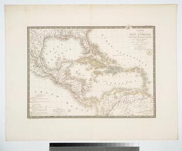
"par A. Brué Geographe du Roi." "Gravee sous le direction de l'Auteur." "Atlas Universel." "Pl 55" Prime meridian: Paris. Relief: hachures. Graphic Scale: Leagues, miles. Projection: Conic. Printing Process: Copper engraving. Verso Text: MS note: 946.
105:946 M
Image not available
Visual Materials
Kashnor notes, "Shows Alaska, the Estuary of the Mackenzie, and the country south of Prince of Wales Archipelago, as well as a good map of Kamtschatka." Same as 105:011, but with reduced margins. Above neat line right; Atlas Universel Pl. 26. Below neat line left; Graveé sous la direction de l'Auteur. Engraved stamp upper left; Carte Encyprotipe du fonds de l'Auteur. Submap "Complément des Regions Polaires Boréalis." Shows area from Greenland to Hudson's Bay.. Prime meridian: GM. Relief: hachures. Graphic Scale: No. Projection: Equidistant Conic. Printing Process: Copper engraving. Other Features: Sub-maps. Verso Text: Ms. note: No. 10.
093:010 S
Image not available
Visual Materials
Seal embossed bottom right "Catre Encyprotipe du fonds de l'Auteur." Surrounding seal, "Depuis 1822 l'auteur ne donne ses soins qu'aux cartes quiportent son adresse et ce timbre. Il est étranger depuis cette époque a tout travail ou changement de date des autres cartes.". Prime meridian: Ferro. Relief: pictorial. Graphic Scale: No. Projection: Dual Hemisphere. Printing Process: Copper engraving. Verso Text: MS note:37.
105:037 M
Image not available
Visual Materials
Kashnor notes, "Shows a good coastline to the North-West, and embodies the last discoveries of Cook, and one of the earliest maps to show them. Locates Sir. Fr. Drake's Harbour and Monterey." For another copy see HEH 99126. Printed in two sections. The upper section contains the date June 1, 1781 in the heading. The lower section notes the date as June 15, 1780 and only mentioned R. Sayer as the seller. A very busy map with many diagrams, explanations and tables. Submaps of solar system, northern and southern astronomical systems, Analemma system (orthographic projection system) with explanation, moon's surface, Mercator map of World, Seasons and a universal Mathematical Scale. Prime meridian: Ferro. Relief: pictorial. Projection: Dual Hemisphere. Watermark: Crowned fleur-de-lis V. Printing Process: Copper engraving. Verso Text: Ms note: 293.
105:293 M