Manuscripts
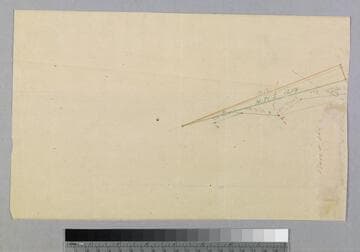
Olive Street Grade - sketch map

You might also be interested in

"G" Miscellaneous - sketch maps
Manuscripts
#1A: sketch on O'Melveny & Trantum stationery [from O.O. Trantum] showing lot with water ditches & S.P. railroad, structure, distances, markers; #1B: very rough sketch on verso; additional sketch on sheet with courses & calculations, showing River, Chavis and other parcel owners [not scanned]. Title supplied by cataloger.
mssSolano SR_Box_28(44).01A

"G" Miscellaneous : sketch maps
Manuscripts
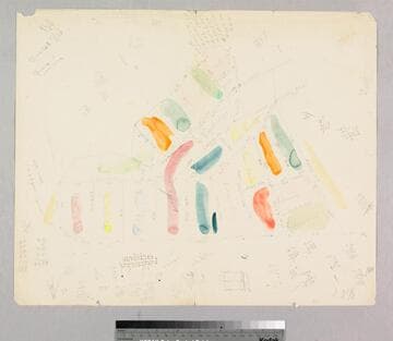
#1A: sketch on O'Melveny & Trantum stationery [from O.O. Trantum] showing lot with water ditches & S.P. railroad, structure, distances, markers; #1B: very rough sketch on verso; additional sketch on sheet with courses & calculations, showing River, Chavis and other parcel owners [not scanned]. Title supplied by cataloger.
mssSolano SR_Box_28(44).01B
Mansfield - sketch maps - Lots at Main & 12th Streets
Manuscripts
#1A: front side showing parcel owners along Main Street including Mansfield, Childs, south of 12th St. Sketch on verso in colored pencil showing courses, distances of wedge-shaped lot. Title supplied by cataloger.
mssSolano SR_Box_30(10).01A
Rancho la Ballona : 1875 partition - colored sketch map of partition
Manuscripts
Shows parcel owners, courses, distances; awash with pencil calculations Verso: calculations & doodles. Title supplied by cataloger.
mssSolano SR_Box_20(05).10

Rancho la Ballona : 1875 partition - sketch map of partition
Manuscripts
Parcel owners, distances, courses; pencil calculations; sketched additions to subdivision Verso: incomplete pencil drawing. Title supplied by cataloger.
mssSolano SR_Box_20(05).11
Image not available
Macy, Obed - sketch maps
Manuscripts
P. 1 & verso of document, "Bella Union Hotel property described in Sheriff's sale..." showing distances in feet, parcel owners. Title supplied by cataloger.
mssSolano SR_Box_30(05)