Manuscripts
Road to San Gabriel

You might also be interested in

Road to San Gabriel with R.R. Workshops, County Hospital
Manuscripts
Surveyed by Alfred Solano at the request of H.M. Johnston. ; Delineated by G. B. King.. From Downey Avenue to S.P.R.R., south of Rose St.. Color highlighting, hachures, courses, distances indicated. Alt title supplied by cataloger.
mssSolano SR_Map_0541.03

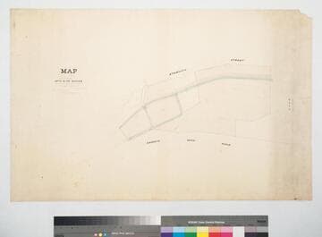
Map of Lots 1-7 in the Junction Block
Manuscripts
San Fernando St. to Downey Ave. from their junction to Aurora St., showing structures, lot owners; red, blue, black inks; courses, distances, hachures; shows subdivision of Hellman, Haas & Co.. Originally surveyed by L. Seebold. Paper watermark: Royal Linen Ledger. Alt title supplied by cataloger.
mssSolano SR_Map_0707

County Roads to San Gabriel : 50 acre tract
Manuscripts
P. 8 of fastened document, "Road to San Gabriel, passing through land of H.M. Johnston..." showing Old Mission Road and S.P.R.R., surface details, courses, distances, parcel owners, waterway. Title supplied by cataloger.
mssSolano SR_Box_31(33).01
Land belonging to Mrs. A. B. de Baker
Manuscripts
Eternity St. to Arroyo Seco Road west of the S.P.R.R. depot grounds, showing Mill and other structures; hachures; acreage & bearings. Other parcel owners: Ybarra & J. Mullally. [Mrs. Arcadia Bandini de Baker]. Alt title supplied by cataloger.
mssSolano SR_Map_0450

Lots 5 & 6 Bl. 59 Hancock's Survey
Manuscripts
West from Soto St. past Boyle Ave. along Stevenson Ave., also showing part of Block 58, with color highlighting, parcel owners, courses, acreage, distances; pencil annotations, hachures, calculations. Table of courses, distances for Sarah H. Higgins parcel. Alt title supplied by cataloger.
mssSolano SR_Map_0597

Los Angeles : Vigne and Moulton parcels south of road to Mission San Gabriel
Manuscripts
Courses, distances; parcel owners. [see also Map 680]. Moulton tract surveyed Dec. 26, 1887. Paper watermark: Royal Linen Ledger. Title supplied by cataloger.
mssSolano SR_Map_0677