Manuscripts
Map of the City of Los Angeles. showing the confirmed limits

You might also be interested in

Map of Los Angeles City
Manuscripts
(rest of map missing) showing northern half of Los Angeles, ; surrounding area: Rancho los Felis, Roches; Rosa de Castilla, Granger & Berdugo parcels; structures, very fine surface & topographical detailing: subdivision, roads, hills; color highlighting.
mssSolano SR_Map_0324.01A

Map of Los Angeles City
Manuscripts
(rest of map missing) showing northern half of Los Angeles, ; surrounding area: Rancho los Felis, Roches; Rosa de Castilla, Granger & Berdugo parcels; structures, very fine surface & topographical detailing: subdivision, roads, hills; color highlighting
mssSolano SR_Map_0324.01B

Map Showing the Lands of W.H. Workman situated on the East Side of Los Angeles River
Manuscripts
Original survey by J. H. Wildy, January 1876 . Blocks 59, 60, 72, & 73, Hancock's Survey, Showing structures and surface detail: very fine hachures, color highlighting, waterways, parcel owners & some title history. ; Copied by Joseph A. Bernal. Alt title supplied by cataloger.
mssSolano SR_Map_0461
Map showing the Donation Lots
Manuscripts
Hancock's Survey [1857 August], within confirmed City Limits and in Pueblo Lands, with relationship to ranchos los Felis, las Ciénegas, San Antonio, and Rosa de Castilla, with explanatory text, lot owners. Alt title supplied by cataloger.
mssSolano SR_Map_0334

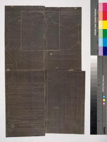
Los Angeles County - Alphabetical Index to lots in County Record Book - Manuel Romero parcel
Manuscripts
Showing bordering waterways, courses, distances, parcel owners, hachures. Title supplied by cataloger.
mssSolano SR_Box_29(33).06

Lands of the Los Angeles City Water Co
Manuscripts
Eternity & Buena Vista St. east past San Fernando St. from south of Virgin St. to junction of the two San Fernando Sts., showing structures, vegetation, hachures, ; waterways, parcel owners, deed & title information; color highlighting. Inset: Part of Ord's Map.
mssSolano SR_Map_0799